Arlington, KS
| Arlington, Kansas | |
|---|---|
| City | |
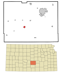
 Location within Reno County and Kansas |
|
 KDOT map of Reno County (legend) |
|
| Coordinates: 37°53′47″N 98°10′46″W / 37.89639°N 98.17944°WCoordinates: 37°53′47″N 98°10′46″W / 37.89639°N 98.17944°W | |
| Country | United States |
| State | Kansas |
| County | Reno |
| Area | |
| • Total | 1.07 sq mi (2.77 km2) |
| • Land | 1.07 sq mi (2.77 km2) |
| • Water | 0 sq mi (0 km2) |
| Elevation | 1,594 ft (486 m) |
| Population (2010) | |
| • Total | 473 |
| • Estimate (2015) | 457 |
| • Density | 440/sq mi (170/km2) |
| Time zone | CST (UTC-6) |
| • Summer (DST) | CDT (UTC-5) |
| ZIP code | 67514 |
| Area code | 620 |
| FIPS code | 20-02325 |
| GNIS ID | 0473622 |
Arlington is a city in Reno County, Kansas, United States. As of the 2010 census, the city population was 473.
Arlington was founded in 1877. It was named after Arlington, Massachusetts. The first post office in Arlington was established in February 1878.
In 1887, the Chicago, Kansas and Nebraska Railway built a main line from Herington through Arlington to Pratt. In 1888, this line was extended to Liberal. Later, it was extended to Tucumcari, New Mexico and El Paso, Texas. It foreclosed in 1891 and taken over by Chicago, Rock Island and Pacific Railway, which shut down in 1980 and reorganized as Oklahoma, Kansas and Texas Railroad, merged in 1988 with Missouri Pacific Railroad, merged in 1997 with Union Pacific Railroad. Most locals still refer to this railroad as the "Rock Island".
Arlington is located at 37°53′47″N 98°10′46″W / 37.89639°N 98.17944°W (37.896363, -98.179313). According to the United States Census Bureau, the city has a total area of 1.07 square miles (2.77 km2), all land.
...
Wikipedia
