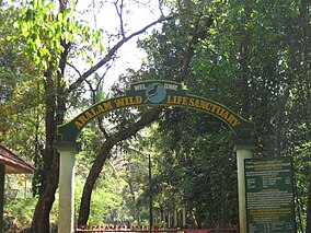
Aralam Wildlife Sanctuary
| Aralam Wildlife Sanctuary | |
|---|---|

Entrance
|
|
| Location | Kerala, southwest India |
| Coordinates | 11°52′44″N 75°53′19″E / 11.87878°N 75.88864°ECoordinates: 11°52′44″N 75°53′19″E / 11.87878°N 75.88864°E |
| Area | 55 km2 (21 sq mi) |
| Established | 1984 |
| www |
|
Aralam Wildlife Sanctuary is the northernmost wildlife sanctuary of Kerala, southwest India. It is 55 km2 (21 sq mi) in area and located on the western slope of the Western Ghats. It was established in 1984. The headquarters of the sanctuary is near Iritty. Aralam Wildlife Sanctuary is situated in the southeast part of Kannur District. It lies between 11° 54′ and 11° 59′ north latitude and 75° 47′ and 75° 57′ east longitude.
The sanctuary area falls in Aralam, Kelakam and Kottiyoor revenue villages and is located in the northwest slopes of Western Ghats contiguous with the forests of Coorg (Kodagu) district of Karnataka state.
The PA (protected area) consists of Aralam Range, the only range of Aralam wildlife division, which is part of Northern Wildlife Circle (Northern Region) Palakkad. The extent of the sanctuary is 55 square kilometres (21 sq mi). The sanctuary was constituted in 1984 as per GO (P) 300/84/AD dated 15 October 1984.
It was formed by carving out areas from the Odanthode Malavaram of Thalassery special division which was an erstwhile private forest, subsequently taken over by Govt. as per the provisions of the Kerala Private Forests (vesting and assignment) Act 1971 and from the Kottiyoor RF of Wayanad Forest Division.
The vested forest portion of the sanctuary is 32.64 square kilometres (12.60 sq mi) and the 22.36 km2 is part of Kottiyoor RF (Reserved Forest).
Till 30.6.98 this sanctuary was a range in Wayanad Wildlife Division. It started functioning as an independent wildlife division since 1.7.98 as per GO (MS) 36/98 dated 27.5.98.
In the First Management Plan the entire area was divided into two zones viz: the Core Zone and the Buffer Zone.Climatic factors include rainfall, temperature, humidity, frost and so on.
Rainfall data available in the Central State Farm, Aralam, which is just adjoining to the sanctuary area has been analysed. Major source of moisture in the tract is in the form of rainfall. The total annual rainfall seldom falls below 4000 mm. The maximum annual value for the nine years data available is 5052.60 mm and the minimum is 3745.50 mm. In specialised localities, in the higher reaches (where there are no rain gauges), the rainfall goes as high as over 6000 mm. Most (more than 70%) of the rainfall is obtained during the southwest monsoon in June, July and August months.
The retreating monsoon though less pronounced, is an important source of moisture in October, November and December, which constitutes 14% of the total. Summer rains vary widely and is not dependable.
...
Wikipedia

