Anticosti Island
| Anticosti Island (Île d'Anticosti) | |
|
Salmon fisherman on Rivière à l'Huile
|
|
| Country | Canada |
|---|---|
| Province | Quebec |
| Region | Côte-Nord |
| Regional County | Minganie |
| Municipality | L'Île-d'Anticosti |
| Settlement | Port-Menier |
| Location | Gulf of Saint Lawrence |
| - coordinates | 49°30′N 63°00′W / 49.500°N 63.000°WCoordinates: 49°30′N 63°00′W / 49.500°N 63.000°W |
| Highest point | |
| - elevation | 300 m (984 ft) |
| Length | 217 km (135 mi), E-W |
| Width | 16 km (10 mi), N-S |
| - width 1 | 48 km (30 mi) |
| Area | 7,923.16 km2 (3,059 sq mi) |
| - land | 7,892.15 km2 (3,047 sq mi) |
| Population | 240 |
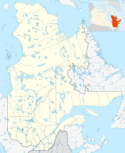
Anticosti Island (French, Île d'Anticosti) is an island in the province of Quebec, Canada at the outlet of the Saint Lawrence River into the Gulf of Saint Lawrence, between 49° and 50° N., and between 61° 40' and 64° 30' W. At 7,892.52 km2 (3,047.32 sq mi) in size, it is the 90th largest island in the world and 20th largest island in Canada. Anticosti Island is separated on the north from the Côte-Nord region of Quebec (the Labrador Peninsula) by the Jacques Cartier Strait, and on the south from the Gaspé Peninsula by the Honguedo Strait.
Anticosti Island is larger than Prince Edward Island but sparsely populated (240 people in 2011), with most of the permanent population in the village of Port-Menier on the western tip of the island, consisting chiefly of the keepers of the lighthouses erected by the Canadian government. The entire island constitutes one municipality known as L'Île-d'Anticosti.
Due to more than 400 shipwrecks off its coasts, Anticosti Island is sometimes called the "Cemetery of the Gulf".
Anticosti Island is part of the eastern Saint Lawrence lowlands. It is 217 km (135 mi) long and has a maximum breadth of 48 km (30 mi)—1½ times as large as the province of Prince Edward Island. Its coastline is 520 km (320 mi) long, and is rocky and dangerous, offering little shelter for ships except in Gamache, Ellis, and Fox Bays. There are large shoals to the south.
...
Wikipedia


