Antelope Valley Freeway
| State Route 14 | ||||
|---|---|---|---|---|
 |
||||
| Route information | ||||
| Defined by | ||||
| Maintained by Caltrans | ||||
| Length: | 116.645 mi (187.722 km) | |||
| Existed: | 1964 renumbering (from US 6) – present | |||
| Major junctions | ||||
| South end: |
|
|||
| North end: |
|
|||
| Highway system | ||||
|
||||
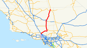
State Route 14 (SR 14) is a north–south state highway in the U.S. state of California, largely in the Mojave Desert. The southern portion of the highway is signed as the Antelope Valley Freeway. The route connects Interstate 5, or Golden State Freeway, on the border of the city of Santa Clarita to the north and the Los Angeles neighborhoods of Granada Hills and Sylmar to the south, with U.S. Route 395 near Inyokern. Legislatively, the route extends south of I-5 to State Route 1 in the Pacific Palisades area of Los Angeles, however the portion south of the junction with I-5 has not been constructed. The southern part of the constructed route is a busy commuter freeway serving and connecting the cities of Santa Clarita, Palmdale, and Lancaster with the rest of the Greater Los Angeles area. The northern portion, from Vincent (south of Palmdale) to Route 395, is legislatively named the Aerospace Highway, as the highway serves Edwards Air Force Base, once one of the primary landing strips for NASA's Space Shuttle. This section is rural, following the line between the hot Mojave desert and the forming Sierra Nevada mountain range. Most of Route 14 is loosely paralleled by a main line of the Southern Pacific Railroad, used for the Antelope Valley Line of the Metrolink commuter rail system as well as a connection between Los Angeles and the Central Valley via Tehachapi Pass.
...
Wikipedia

