Annapolis Royal, Nova Scotia
| Annapolis Royal | ||
|---|---|---|
| Town | ||

Seaward view at Annapolis Royal
|
||
|
||
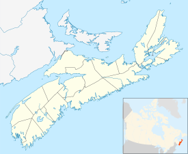
| Location of Annapolis Royal, Nova Scotia | ||
| Coordinates: 44°44′30″N 65°30′55″W / 44.74167°N 65.51528°WCoordinates: 44°44′30″N 65°30′55″W / 44.74167°N 65.51528°W | ||
| Country |
|
|
| Province |
|
|
| Municipality | Annapolis County | |
| Founded | 1605 (as Port Royal) | |
| Incorporated | November 29, 1892 | |
| Electoral Districts Federal |
West Nova |
|
| Provincial | Annapolis | |
| Government | ||
| • Mayor | Bill MacDonald | |
| • Governing Body | Annapolis Royal Town Council | |
| • MLA | Stephen McNeil (L) | |
| • MP | Colin Fraser (L) | |
| Area (2016) | ||
| • Total | 2.04 km2 (0.79 sq mi) | |
| Highest elevation | 7 m (23 ft) | |
| Lowest elevation | 0 m (0 ft) | |
| Population (2016) | ||
| • Total | 491 | |
| • Density | 240.8/km2 (624/sq mi) | |
| Demonym(s) | Annapolitan | |
| Time zone | AST (UTC-4) | |
| Postal code | B0S1A0 | |
| Area code(s) | 902 | |
| Telephone Exchange | 526, 532 | |
| Median Earnings* | $40,949 | |
| NTS Map | 021A12 | |
| GNBC Code | CAASF | |
| Website | [1] | |
|
||
| Official name | Annapolis Royal Historic District National Historic Site of Canada | |
| Designated | 1994 | |
Annapolis Royal, formerly known as Annapolis, is a town located in the western part of Annapolis County, Nova Scotia, Canada.
Annapolis Royal was the French settlement of Port Royal (briefly Charlesfort) until the Siege of Port Royal in 1710 by Britain. The town was the capital of Acadia and later Nova Scotia for almost 150 years, until the founding of the City of Halifax in 1749. It was attacked by the British six times before permanently changing hands after the Siege of Port Royal in 1710. Over the next fifty years, the French and their allies made six unsuccessful military attempts to regain the capital. Including a raid during the American Revolution, Annapolis Royal faced a total of thirteen attacks, more than any other place in North America. As the site of several pivotal events during the early years of the colonisation of Canada, the historic core of Annapolis Royal was designated a National Historic Site of Canada in 1994.
Annapolis Royal is situated in a good but shallow harbor at the western end of the fertile Annapolis Valley, nestled between the North and South mountains which define the valley. The town is on south bank of the Annapolis River facing the heavily tidal Annapolis Basin. The riverside forms the waterfront for this historic town. Directly opposite Annapolis Royal on the northern bank of the river is the community of Granville Ferry. Allains Creek joins the Annapolis River at the town, defining the western side of the community. The Bay of Fundy is just over the North Mountain, 10 kilometers north of the town.
The original French settlement at present-day Port Royal, known as the Habitation at Port-Royal, was settled in 1605 by François Gravé Du Pont, Samuel de Champlain, with and for Pierre Dugua, Sieur de Mons. (Annapolis Royal is twinned with the town of Royan in France, birthplace of Sieur de Mons.) The Port-Royal site is approximately 10 km (6.2 mi) west of present-day Annapolis Royal at the mouth of the Annapolis River on the Annapolis Basin. The first settlement was abandoned after being destroyed by British-American attackers in 1613, but was probably the site of the introduction of apples to Canada in 1606.
...
Wikipedia

