Andover, New Jersey
| Andover, New Jersey | |
|---|---|
| Borough | |
| Borough of Andover | |

Andover, New Jersey
|
|
 Map of Andover Borough in Sussex County. Inset: Location of Sussex County in New Jersey. |
|
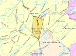
 Census Bureau map of Andover, New Jersey. |
|
| Coordinates: 40°59′09″N 74°44′37″W / 40.985758°N 74.74359°WCoordinates: 40°59′09″N 74°44′37″W / 40.985758°N 74.74359°W | |
| Country | |
| State |
|
| County | Sussex |
| Incorporated | March 25, 1904 |
| Named for | Andover, Hampshire, England |
| Government | |
| • Type | Borough |
| • Body | Borough Council |
| • Mayor | John A. Morgan (R, term ends December 31, 2019) |
| • Clerk | Beth Brothman |
| Area | |
| • Total | 1.471 sq mi (3.810 km2) |
| • Land | 1.452 sq mi (3.761 km2) |
| • Water | 0.019 sq mi (0.048 km2) 1.27% |
| Area rank | 454th of 566 in state 21st of 24 in county |
| Elevation | 646 ft (197 m) |
| Population (2010) | |
| • Total | 606 |
| • Estimate (2015) | 581 |
| • Rank | 549th of 566 in state 23rd of 24 in county |
| • Density | 417.3/sq mi (161.1/km2) |
| • Density rank | 458th of 566 in state 10th of 24 in county |
| Time zone | Eastern (EST) (UTC-5) |
| • Summer (DST) | Eastern (EDT) (UTC-4) |
| ZIP code | 07821 |
| Area code(s) | 973 exchange: 786 |
| FIPS code | 3403701330 |
| GNIS feature ID | 885140 |
| Website | www |
Andover is a borough in Sussex County, New Jersey, United States. As of the 2010 United States Census, the borough's population was 606, reflecting a decline of 52 (-7.9%) from the 658 counted in the 2000 Census, which had in turn declined by 42 (-6.0%) from the 700 counted in the 1990 Census.
Andover was incorporated as a borough by an act of the New Jersey Legislature on March 25, 1904, from portions of Andover Township. The borough was named for Andover, Hampshire, England.
According to the United States Census Bureau, the borough had a total area of 1.471 square miles (3.810 km2), including 1.452 square miles (3.761 km2) of land and 0.019 square miles (0.048 km2) of water (1.27%).
As of the 2010 United States Census, there were 606 people, 241 households, and 163.9 families residing in the borough. The population density was 417.3 per square mile (161.1/km2). There were 263 housing units at an average density of 181.1 per square mile (69.9/km2). The racial makeup of the borough was 91.75% (556) White, 1.16% (7) Black or African American, 0.33% (2) Native American, 2.15% (13) Asian, 0.00% (0) Pacific Islander, 2.64% (16) from other races, and 1.98% (12) from two or more races. Hispanic or Latino of any race were 7.59% (46) of the population.
...
Wikipedia
