Anacapa Island
| Native name: Ennepah, 'Anyapakh | |
|---|---|

Aerial view of Anacapa with the lighthouse and coastguard station on East Anacapa in the foreground and Middle and West Anacapa behind. Santa Cruz Island is on the horizon.
|
|
|
Anacapa Island
|
|
| Etymology | mirage island |
| Geography | |
| Location | Pacific Ocean |
| Archipelago | Northern Channel Islands |
| Adjacent bodies of water | Pacific Ocean |
| Major islands | West, Middle, East |
| Area | 699 acres (283 ha) |
| Length | 6 mi (10 km) |
| Highest elevation | 930 ft (283 m) |
| Highest point | Vela Peak/Summit Peak 2 |
| Administration | |
|
United States
|
|
| State | California |
| County | Ventura |
| Demographics | |
| Population | 3 (2000) |
| Additional information | |
| Official website | http://www.nps.gov/chis/planyourvisit/anacapa.htm |
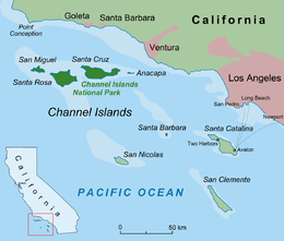
Anacapa Island is a small volcanic island located about 11 miles (18 km) off the coast of Port Hueneme, California, in Ventura County. The island is composed of a series of narrow islets 6 mi (10 km) long, oriented generally east-west and 5 mi (8 km) east of Santa Cruz Island. The three main islets, East, Middle and West Anacapa, are collectively known as The Anacapas by some authors. All three islets have precipitous cliffs, dropping off steeply into the sea.
Anacapa is the smallest of the northern islands of the Channel Islands archipelago, and is within the Channel Islands National Park.
Along with Santa Barbara Island, Anacapa was formed by volcanic eruptions between 19 and 15 million years ago. These eruptions are believed to have been caused by thinning of ocean crust as the block containing the northern Channel Islands and Santa Monica mountains was rotated clockwise by the transverse motion of the Pacific and North American plates. Lava from these eruptions can be found across the region, and in depths of up to 10,000 feet (3,000 m). The rocks that make up Anacapa are composed of lava, breccias, volcanic ash and cinders.
Erosion has heavily weathered the lava formations of Anacapa, and wave action caused the island to split into three islets in recent prehistoric times. The islets display a wide variety of erosional features including sea arches, sea caves, stacks, wave-cut platforms, surge channels and blowholes.
West Anacapa is the largest and highest islet, rising to an altitude of 930 ft (283 m) at Vela Peak, also known as Summit Peak 2. East and Middle Anacapa have fairly level areas at their tops. Middle Island reaches an altitude of 325 ft (99 m) and East Island is 250 ft (76 m) at its highest point. All three islands total 699 acres (283 ha), or about 1.1 square miles (2.8 km2).
...
Wikipedia


