Ami, Ibaraki
|
Ami 阿見町 |
|||
|---|---|---|---|
| Town | |||

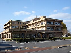
Ami town office
|
|||
|
|||
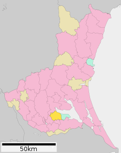
 Location of Ami in Ibaraki Prefecture |
|||
| Coordinates: 36°1′50.9″N 140°12′53.4″E / 36.030806°N 140.214833°ECoordinates: 36°1′50.9″N 140°12′53.4″E / 36.030806°N 140.214833°E | |||
| Country | Japan | ||
| Region | Kantō | ||
| Prefecture | Ibaraki Prefecture | ||
| District | Inashiki | ||
| Area | |||
| • Total | 71.40 km2 (27.57 sq mi) | ||
| Population (September 2015) | |||
| • Total | 48,019 | ||
| • Density | 673/km2 (1,740/sq mi) | ||
| Time zone | Japan Standard Time (UTC+9) | ||
| - Tree | Sakura | ||
| - Flower | Chrysanthemum | ||
| - Bird | Japanese bush warbler | ||
| Phone number | 0296-48-1111 | ||
| Address | 1-1-1 Chuo, Ami-machi, Inashiki-gun, Ibaraki-ken 300-0332 | ||
| Website | Official website | ||
Ami (阿見町 Ami-machi?) is a town located in Inashiki District, Ibaraki Prefecture, in the northern Kantō region of Japan. As of September 2015, the town had an estimated population of 48,019 and a population density of 673 persons per km². Its total area was 71.40 km².
Located in southern Ibaraki Prefecture, Ami is bordered to the north by Lake Kasumigaura
During the Edo period, the area around Ami was part of Hitachi Province. The villages of Ami, Kimihara, Asahi and Funashima were created with the establishment of the municipalities system on April 1, 1889. In 1921, the Imperial Japanese Navy established a naval aviation training base at Ami, with floatplane operations on nearby Kasumigaura. Zeppelin operations also began from 1929. In 1937, the Youth Aviation Squadron was transferred from Yokosuka. The base was repeated bombed in 1944 and 1945 during World War II, with the attack on June 10, 1945 killing over 300 people. On April 1, 1955, the villages of Ami, Kimihara and Asahi merged to form the town of Ami. Most of the village of Funashima joined on April 20, 1955.
Ami has a mixed economy. Agriculture remains predominant; however, there are also numerous factories for chemicals, light manufacturing and electronics.
...
Wikipedia


