Altendorf, Switzerland
| Altendorf | ||
|---|---|---|
 |
||
|
||
| Coordinates: 47°11′N 8°49′E / 47.183°N 8.817°ECoordinates: 47°11′N 8°49′E / 47.183°N 8.817°E | ||
| Country | Switzerland | |
| Canton | Schwyz | |
| District | March | |
| Area | ||
| • Total | 20.4 km2 (7.9 sq mi) | |
| Elevation | 421 m (1,381 ft) | |
| Population (Dec 2015) | ||
| • Total | 6,744 | |
| • Density | 330/km2 (860/sq mi) | |
| Postal code | 8852 | |
| SFOS number | 1341 | |
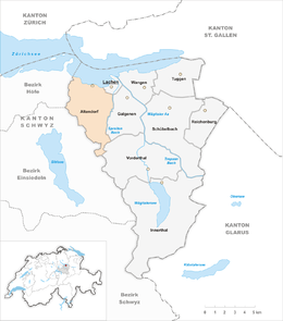
| Surrounded by | Einsiedeln, Freienbach, Galgenen, Jona (SG), Lachen, Rapperswil (SG), Vorderthal | |
| Website |
www SFSO statistics |
|
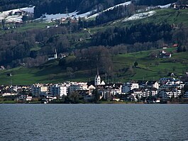
Altendorf is a municipality in March District in the canton of Schwyz in Switzerland.
Altendorf is first mentioned in 972 as Rahprehteswilare.
In 1932, construction started on the Etzelwerk, a hydro-electric power station to generate power for the Swiss Federal Railways. By 1937, the power station was complete and in operation. The plant continues in use today, and takes its water supply from the Sihlsee reservoir that lies 5 kilometres (3 mi) to the south-west.
Altendorf has an area, as of 2006[update], of 20.5 km2 (7.9 sq mi). Of this area, 52.6% is used for agricultural purposes, while 37.5% is forested. Of the rest of the land, 9.4% is settled (buildings or roads) and the remainder (0.4%) is non-productive (rivers, glaciers or mountains).
The municipality is located on the Obersee section of Lake Zurich. It is along the rail line Pfäffikon-Lachen and on the A3 motorway. It consists of the village of Altendorf and the hamlets of Seestatt along the lake and the hamlets of Muschelberg, Mittlisberg, Schlipf and Vorderberg in the pre-alpine hills as well as a suburb of Lachen, the hamlet of Steinegg.
Altendorf has a population (as of 31 December 2015) of 6,744. As of 2007[update], 16.8% of the population was made up of foreign nationals. Over the last 10 years the population has grown at a rate of 32.4%. Most of the population (as of 2000[update]) speaks German (91.1%), with Italian being second most common ( 1.4%) and Albanian being third ( 1.3%).
...
Wikipedia


