Alorton, Illinois
| Alorton | |
| Village | |
| Country | United States |
|---|---|
| State | Illinois |
| County | St. Clair |
| Municipality | 1944 |
| Coordinates | 38°35′3″N 90°7′4″W / 38.58417°N 90.11778°WCoordinates: 38°35′3″N 90°7′4″W / 38.58417°N 90.11778°W |
| Area | 1.83 sq mi (5 km2) |
| - land | 1.78 sq mi (5 km2) |
| - water | 0.05 sq mi (0 km2) |
| Population | 1,964 (2012) |
| Density | 1,104/sq mi (426/km2) |
| Timezone | CST (UTC-6) |
| - summer (DST) | CDT (UTC-5) |
| Postal code | 62207 |
| Area code | 618 |
|
Location in St. Clair County and the state of Illinois.
|
|
|
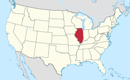
Location of Illinois in the United States
|
|
Alorton (formerly Alcoa) is a village in St. Clair County, Illinois, United States. The estimated 2012 population was 1,964. The population was 2,002 in 2010, down from 2,749 in 2000.
Alorton was home to Cahokia Downs, an American horse racing track located on Highway 15 which hosted both Standardbred harness racing and Thoroughbred flat racing events from 1954 until 1979.
The name Alorton is most likely an abbreviation of "aluminum ore town".
Alorton is located at 38°35′3″N 90°7′4″W / 38.58417°N 90.11778°W (38.584094, -90.117720).
According to the 2010 census, Alorton has a total area of 1.83 square miles (4.74 km2), of which 1.8 square miles (4.66 km2) (or 98.36%) is land and 0.03 square miles (0.08 km2) (or 1.64%) is water.
As of the census of 2000, there were 2,749 people, 886 households, and 670 families residing in the village. The population density was 1,545.3 people per square mile (596.3/km²). There were 1,000 housing units at an average density of 562.1 per square mile (216.9/km²). The racial makeup of the village was 1.56% White, 97.09% African American, 0.15% Native American, 0.25% from other races, and 0.95% from two or more races. Hispanic or Latino of any race were 0.73% of the population.
...
Wikipedia


