Almond, Wisconsin
| Almond, Wisconsin | |
|---|---|
| Village | |
| Motto: "Soar with eagle pride" | |
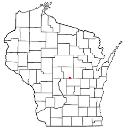
 Location of Almond, Wisconsin |
|
| Coordinates: 44°17′41″N 89°25′28″W / 44.29472°N 89.42444°W | |
| Country | United States |
| State | Wisconsin |
| County | Portage |
| Area | |
| • Total | 1.01 sq mi (2.62 km2) |
| • Land | 1.01 sq mi (2.62 km2) |
| • Water | 0 sq mi (0 km2) |
| Elevation | 1,155 ft (352 m) |
| Population (2010) | |
| • Total | 448 |
| • Estimate (2012) | 444 |
| • Density | 443.6/sq mi (171.3/km2) |
| Time zone | Central (CST) (UTC-6) |
| • Summer (DST) | CDT (UTC-5) |
| Area code(s) | 715 & 534 |
| FIPS code | 55-01425 |
| GNIS feature ID | 1582683 |
| Website | http://www.villageofalmond.com |
Almond is a village in Portage County, Wisconsin, United States. The population was 448 at the 2010 census.
Incorporated in 1905, the town originated when Jacob Meyers from Mohawk Valley, New York, started a stagecoach and freight route between Berlin and Stevens Point. He needed a stop for the horses between route so he set up a barn and inn on the site of what is now Almond. The U.S. government signed a treaty with the Menominee Indians ceding land in central Wisconsin in 1848, which opened up the area to settlement. A post office was established on July 8, 1850, at the stagecoach stop. James F. Moore, a native of Almond N.Y., became postmaster.
Almond is located at 44°15′32″N 89°24′25″W / 44.25889°N 89.40694°W.
According to the United States Census Bureau, the village has a total area of 1.01 square miles (2.62 km2), all of it land.
As of the census of 2010, there were 448 people, 174 households, and 119 families residing in the village. The population density was 443.6 inhabitants per square mile (171.3/km2). There were 197 housing units at an average density of 195.0 per square mile (75.3/km2). The racial makeup of the village was 94.0% White, 0.2% African American, 0.4% Native American, 0.4% Asian, 3.8% from other races, and 1.1% from two or more races. Hispanic or Latino of any race were 13.2% of the population.
...
Wikipedia
