Allatoona Dam
| Allatoona Dam | |
|---|---|
 |
|
|
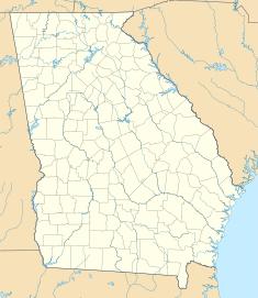
Location of Allatoona Dam in Georgia (U.S. state)
|
|
| Country | United States |
| Location | Cartersville, Georgia |
| Coordinates | 34°09′50″N 84°43′41″W / 34.164°N 84.728°WCoordinates: 34°09′50″N 84°43′41″W / 34.164°N 84.728°W |
| Purpose | Power, flood control, water supply, recreation |
| Status | Operational |
| Construction began | 1946 |
| Opening date | 1950 |
| Construction cost | US$31.5 million (Equivalent to US$317 million in 2017) |
| Owner(s) | U.S. Army Corps of Engineers |
| Dam and spillways | |
| Type of dam | Gravity |
| Impounds | Etowah River |
| Height | 190 ft (58 m) |
| Spillway capacity | 297,000 cu ft/s (8,410 m3/s) |
| Reservoir | |
| Creates | Lake Allatoona |
| Total capacity | 367,500 acre·ft (453,300,000 m3) |
| Catchment area | 1,110 sq mi (2,900 km2) |
| Surface area | 1,210 acres (4.9 km2) |
| Maximum water depth | 145 ft (44 m) |
| Power station | |
| Commission date | 1950 |
| Turbines | 3 |
| Installed capacity | 85 MW (114,000 hp) |
Allatoona Dam is a concrete gravity dam on the Etowah River, located east of Cartersville in Bartow County in the U.S. state of Georgia. It was authorized by the Flood Control Acts of 1941 and 1944. Delayed due to World War II, construction on the dam began in 1946. The reservoir began to fill in during December 1949 and the dam and power station were operation in January 1950. The power station has an installed capacity of 85 MW and the dam facility is owned and operated by the U.S. Army Corps of Engineers.
...
Wikipedia

