Allamuchy, New Jersey
| Allamuchy Township, New Jersey | |
|---|---|
| Township | |
| Township of Allamuchy | |

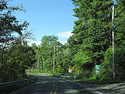
Entering Allamuchy Township along Alphano Road
|
|
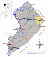
 Map of Allamuchy Township in Warren County. Inset: Location of Warren County highlighted in the State of New Jersey. |
|
 Census Bureau map of Allamuchy Township, New Jersey |
|
| Coordinates: 40°55′12″N 74°49′11″W / 40.920033°N 74.819759°WCoordinates: 40°55′12″N 74°49′11″W / 40.920033°N 74.819759°W | |
| Country | |
| State |
|
| County | Warren |
| Incorporated | April 4, 1873 |
| Named for | Native American word "Allamachetey" ("place within the hills") |
| Government | |
| • Type | Faulkner Act (Small Municipality) |
| • Body | Township Committee |
| • Mayor | Keith DeTombeur (R, term ends December 31, 2018) |
| • Administrator / Clerk | Anne Marie Tracy |
| Area | |
| • Total | 20.763 sq mi (53.777 km2) |
| • Land | 20.454 sq mi (52.977 km2) |
| • Water | 0.309 sq mi (0.800 km2) 1.49% |
| Area rank | 136th of 566 in state 9th of 22 in county |
| Elevation | 623 ft (190 m) |
| Population (2010 Census) | |
| • Total | 4,323 |
| • Estimate (2015) | 4,556 |
| • Rank | 398th of 566 in state 11th of 22 in county |
| • Density | 211.3/sq mi (81.6/km2) |
| • Density rank | 502nd of 566 in state 14th of 22 in county |
| Time zone | Eastern (EST) (UTC-5) |
| • Summer (DST) | Eastern (EDT) (UTC-4) |
| ZIP code | 07820 |
| Area code(s) | 908 exchanges: 813, 852 |
| FIPS code | 3404100670 |
| GNIS feature ID | 0882243 |
| Website | www |
Allamuchy Township is a township in Warren County, New Jersey, United States. As of the 2010 United States Census, the township's population was 4,323, reflecting an increase of 446 (+11.5%) from the 3,877 counted in the 2000 Census.
Allamuchy Township was incorporated as a township by an act of the New Jersey Legislature on April 4, 1873, from portions of Independence Township. The township's name comes from the Native American word "Allamachetey", meaning "place within the hills".
According to the United States Census Bureau, the township had a total area of 20.763 square miles (53.777 km2), including 20.454 square miles (52.977 km2) of land and 0.309 square miles (0.800 km2) of water (1.49%). The townships southeastern border is formed by the Musconetcong River.
Allamuchy CDP (with a 2010 Census population of 78) and Panther Valley (2010 population of 3,327) are census-designated places and unincorporated communities located within the township. As of the 2000 United States Census, the two CDPs were consolidated as Allamuchy-Panther Valley, which had a 2000 Census population of 3,125.
Other unincorporated communities, localities and place names located partially or completely within the township include Alphano, Long Bridge, Quaker Church, Saxton Falls and Warrenville.
As of the 2010 United States Census, there were 4,323 people, 1,953 households, and 1,213 families residing in the township. The population density was 211.3 per square mile (81.6/km2). There were 2,096 housing units at an average density of 102.5 per square mile (39.6/km2). The racial makeup of the township was 93.45% (4,040) White, 1.78% (77) Black or African American, 0.14% (6) Native American, 2.73% (118) Asian, 0.02% (1) Pacific Islander, 0.39% (17) from other races, and 1.48% (64) from two or more races. Hispanic or Latino of any race were 4.49% (194) of the population.
...
Wikipedia
