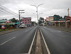
Alitagtag
| Alitagtag | ||
|---|---|---|
| Municipality | ||
 |
||
|
||
 Location within Batangas province |
||
| Location within the Philippines | ||
| Coordinates: 13°52′N 121°00′E / 13.87°N 121°ECoordinates: 13°52′N 121°00′E / 13.87°N 121°E | ||
| Country | Philippines | |
| Region | Calabarzon (Region IV-A) | |
| Province | Batangas | |
| District | 3rd District | |
| Founded | January 1, 1910 | |
| Barangays | 19 (see Barangays) | |
| Government | ||
| • Type | Sangguniang Bayan | |
| • Mayor | Anthony Francis Gainza Andal | |
| Area | ||
| • Total | 24.76 km2 (9.56 sq mi) | |
| Population (2015 census) | ||
| • Total | 25,300 | |
| • Density | 1,000/km2 (2,600/sq mi) | |
| • Voter (2016) | 16,135 | |
| Time zone | PST (UTC+8) | |
| ZIP code | 4205 | |
| IDD : area code | +63 (0)43 | |
| Income class | 4th class | |
| PSGC | 041002000 | |
Alitagtag, officially the Municipality of Alitagtag (Filipino: Bayan ng Alitagtag), is a municipality in the province of Batangas in the Calabarzon (Region IV-A) of the Philippines. The population was 25,300 at the 2015 census. In the 2016 electoral roll, it had 16,135 registered voters.
It is bordered on the north by Taal Lake, east by Cuenca and San Jose, west by Santa Teresita and San Luis, and south by Bauan and San Pascual.
Alitagtag is located at 13°52′N 121°00′E / 13.87°N 121°E.
According to the Philippine Statistics Authority, the municipality has a land area of 24.76 square kilometres (9.56 sq mi) constituting 0.79% of the 3,119.75-square-kilometre- (1,204.54 sq mi) total area of Batangas.
Alitagtag is politically subdivided into 20 barangays. In 1957, the following barrios were created: Pingas, composed of Sitios Pingas and Corral; Tadlak, composed of sitios Tadlak and Malukan; and Sambi composed of the sitio of Sambi.
...
Wikipedia


