Ali Air Base
|
Imam Ali Air Base Tallil AirBase Ali Air Base |
|||||||||||||||
|---|---|---|---|---|---|---|---|---|---|---|---|---|---|---|---|
| Summary | |||||||||||||||
| Airport type | Military: Airbase | ||||||||||||||
| Operator | Iraqi Air Force | ||||||||||||||
| Serves | Nasiriyah | ||||||||||||||
| Elevation AMSL | 13 ft / 4 m | ||||||||||||||
| Coordinates | 30°56′23″N 046°05′33″E / 30.93972°N 46.09250°ECoordinates: 30°56′23″N 046°05′33″E / 30.93972°N 46.09250°E | ||||||||||||||
| Map | |||||||||||||||
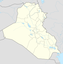
| Location in Iraq | |||||||||||||||
| Runways | |||||||||||||||
|
|||||||||||||||
|
no ILS
|
|||||||||||||||
Imam Ali Air Base (ICAO: ORTL) is a military airbase located near Nasiriyah, Iraq. It is also known as Tallil Air Base. Until December 2011, the base was used by United States Armed Forces. It is generally known as Camp Adder by the U.S. Army; the name "Ali Air Base" is used chiefly by the U.S. Air Force; the installation, however, is still commonly referred to as "Tallil".
The base occupies 30 square kilometers and is protected by 22 kilometers of security perimeter. The ancient Babylonian city of Ur, known as the birthplace of Abraham, is located within the security perimeter for Ali Base, and its ancient ziggurat is visible from nearly every area of the base.
Talil Air Base was an Iraqi Air Force base. The airbase was bombed in Operation Kaman 99 on the second day of the Iran-Iraq war, just after the Iraqi invasion of Iran.
The air base served as the home of a unit of Soviet-built MiG fighter aircraft as well as several Mi-24D (Hind-D) helicopter gunships. The aircraft could be serviced and stored in fortified concrete aircraft hangars located at either end of the main runway. These aircraft shelters, sometimes referred to as "trapezoids" or "Yugos", were built by Yugoslavian contractors sometime prior to 1985, and according to the Gulf War Air Power Survey, there were a total of 36 aircraft shelters in 1991.
...
Wikipedia

