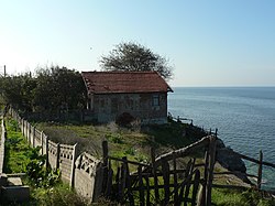
Akçakoca
| Akçakoca | |
|---|---|

Akçakoca beach
|
|
| Coordinates: 41°5′N 31°7′E / 41.083°N 31.117°ECoordinates: 41°5′N 31°7′E / 41.083°N 31.117°E | |
| Country |
|
| Province | Düzce |
| Area | |
| • District | 440.26 km2 (169.99 sq mi) |
| Population (2012) | |
| • Urban | 23,359 |
| • District | 37,216 |
| • District density | 85/km2 (220/sq mi) |
| Climate | Cfb |
Akçakoca is both a town and district of Düzce Province, in the Black Sea region of Turkey, located about 200 km east of Istanbul. The town was named after a Turkish chieftain of the 14th century CE who captured the area for the Ottoman Empire, and sports a statue in his honor. The town features a modern mosque of unusual design. Tourist attractions include beaches and a small ruined castle. It is the regional center of hazelnut cultivation. The mayor is Cüneyt Yemenici (Ak Parti).
In the late 19th and early 20th century, Akçakoca was part of the Kastamonu Vilayet of the Ottoman Empire.
Melen Creek
Autumn in Akçakoca
Fakıllı Cave
...
Wikipedia

