Adel, Georgia
| Adel, Georgia | |
|---|---|
| City | |

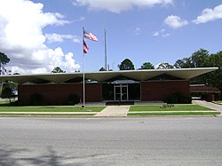
Adel City Hall, 2012
|
|
 Location in Cook County and the state of Georgia |
|
| Coordinates: 31°8′18″N 83°25′33″W / 31.13833°N 83.42583°WCoordinates: 31°8′18″N 83°25′33″W / 31.13833°N 83.42583°W | |
| Country | United States |
| State | Georgia |
| County | Cook |
| Government | |
| • Mayor | Buddy Duke |
| Area | |
| • Total | 8.2 sq mi (21.3 km2) |
| • Land | 8.1 sq mi (20.9 km2) |
| • Water | 0.2 sq mi (0.5 km2) |
| Elevation | 240 ft (73 m) |
| Population (2010) | |
| • Total | 5,334 |
| • Density | 662/sq mi (255.6/km2) |
| Time zone | Eastern (EST) (UTC-5) |
| • Summer (DST) | EDT (UTC-4) |
| ZIP code | 31620 |
| Area code(s) | 229 |
| FIPS code | 13-00576 |
| GNIS feature ID | 0354262 |
| Website | www |
The city of Adel is the county seat of Cook County, Georgia, United States. It is fifty-two miles southeast of Albany. As of the 2010 census, the city had a population of 5,344.
The original name of the city was Puddleville. The city's first postmaster, Joel "Uncle Jack" Parrish, wanted to change the name of the city. It is believed that he saw the name "Philadelphia" on a croaker sack and struck out the first and last four letters to create the present name of Adel.
The Georgia Southern and Florida Railway arrived into Adel in the 1880s. Adel was incorporated as a town in 1889.
On January 22, 2017, a wave of thunderstorms and tornadoes travelled through Adel, ultimately killing 14 during the January 21–22, 2017, tornado outbreak. Sunshine Acres, a local mobile home park near Adel, experienced extreme damage with over 20 homes destroyed and others damaged; 7 residents were killed and an unknown number were injured or displaced.
Adel is located just south of the center of Cook County at 31°8′18″N 83°25′33″W / 31.13833°N 83.42583°W (31.138466, -83.425944). It is bordered to the north by Sparks. U.S. Route 41 passes through the center of town as Hutchinson Avenue, and Interstate 75 passes through the western side of the city, with access from Exit 39. Valdosta is 26 miles (42 km) to the south, and Tifton is 23 miles (37 km) to the north.
...
Wikipedia
