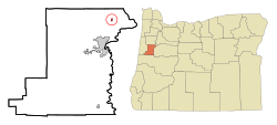
Adair Village
| Adair Village, Oregon | |
|---|---|
| City | |
 Location in Oregon |
|
| Coordinates: 44°40′25″N 123°13′4″W / 44.67361°N 123.21778°WCoordinates: 44°40′25″N 123°13′4″W / 44.67361°N 123.21778°W | |
| Country | United States |
| State | Oregon |
| County | Benton |
| Incorporated | 1976 |
| Government | |
| • Mayor | William (Bill) Currier |
| Area | |
| • Total | 0.23 sq mi (0.60 km2) |
| • Land | 0.23 sq mi (0.60 km2) |
| • Water | 0 sq mi (0 km2) |
| Elevation | 328 ft (100 m) |
| Population (2010) | |
| • Total | 840 |
| • Estimate (2012) | 830 |
| • Density | 3,652.2/sq mi (1,410.1/km2) |
| Time zone | Pacific (UTC-8) |
| • Summer (DST) | Pacific (UTC-7) |
| ZIP code | 97330 |
| Area code(s) | 458 and 541 |
| FIPS code | 41-00275 |
| GNIS feature ID | 1130192 |
| Website | cityofadairvillage.org |
Adair Village is a city in Benton County, Oregon, United States. The population was 840 at the 2010 census.
Adair Village was named after the World War II military installation Camp Adair. When the war ended, the camp was closed and most of the buildings removed, except for the hospital, which in 1946 was leased to Oregon State University for student and faculty housing. The university converted the hospital into apartments, a local government was organized, and Adair Village post office established in 1947.
When the postwar enrollment boom dwindled, Oregon State gave up its lease, and the United States Air Force maintained the base as a radar station. Adair Village post office closed in 1951, and Adair Air Force Station post office took its place from 1961 through 1969. The Air Force ceased operations and sold the property, with the individual houses being placed on the market. Adair Village incorporated in 1976. Adair Village city hall is one of the original World War II buildings.
According to the United States Census Bureau, the city has a total area of 0.23 square miles (0.60 km2), all of it land.
The city is part of the Corvallis, Oregon, Metropolitan Statistical Area.
As of the census of 2010, there were 840 people, 279 households, and 227 families residing in the city. The population density was 3,652.2 inhabitants per square mile (1,410.1/km2). There were 293 housing units at an average density of 1,273.9 per square mile (491.9/km2). The racial makeup of the city was 88.5% White, 1.2% African American, 1.4% Native American, 1.9% Asian, 0.2% Pacific Islander, 0.8% from other races, and 6.0% from two or more races. Hispanic or Latino of any race were 6.7% of the population.
...
Wikipedia
