Ada Ciganlija

Ada Ciganlija
|
|
 |
|
| Geography | |
|---|---|
| Location | Belgrade (Satellite) |
| Coordinates | 44°47′N 20°24′E / 44.783°N 20.400°ECoordinates: 44°47′N 20°24′E / 44.783°N 20.400°E |
| Area | 1.05 sq mi (2.7 km2) |
| Administration | |
| Additional information | |
| Official website | www.adaciganlija.rs |
| Lake Sava | |
|---|---|

Lake Sava in winter
|
|
| Location | Belgrade, Serbia |
| Coordinates | 44°47′21″N 20°24′8″E / 44.78917°N 20.40222°E |
| Type | artificial |
| Primary inflows | Sava |
| Primary outflows | Sava |
| Basin countries | Serbia |
| Max. length | 4.2 km (2.6 mi) |
| Max. width | 200 m (660 ft) |
| Surface area | 0.8 km2 (0.31 sq mi) |
| Average depth | 4 m (13 ft) |
| Max. depth | 14 m (46 ft) |
| Shore length1 | 9 km (5.6 mi) |
| Surface elevation | 78 m (256 ft) |
| Islands | none |
| Settlements | Belgrade |
| 1 Shore length is not a well-defined measure. | |
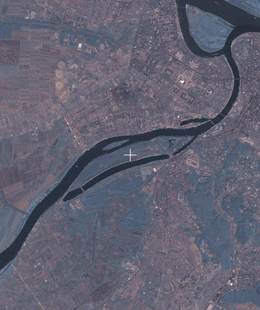
Ada Ciganlija (Serbian Cyrillic: Ада Циганлија, pronounced [ˈǎːda tsiˈɡǎnlija]), colloquially shortened to Ada, is a river island that has artificially been turned into a peninsula, located in the Sava River's course through central Belgrade, the capital of Serbia. The name can also refer to the adjoining artificial Lake Sava and its beach. To take advantage of its central location, over the past few decades, it was turned into an immensely popular recreational zone, most notable for its beaches and sports facilities, which, during summer seasons, can have over 100,000 visitors daily and up to 300,000 visitors over the weekend. Owing to this popularity, Ada Ciganlija has been commonly nicknamed "More Beograda" ("Belgrade's Sea"), which was officially accepted as an advertising slogan in 2008, stylised as More BeogrADA.
Ada Ciganlija is located on the southern bank of the Sava River, 4 km away from its mouth, and entirely belongs to Belgrade's municipality of Čukarica. Its eastern tip roughly borders the urban neighborhood of Senjak on the west (across an inlet called Čukarica Bay), and the body of the peninsula borders the neighborhoods of Čukarica and Makiš (both across Lake Sava). Across the river, Ada Ciganlija borders Novi Beograd (specifically residential bloks and the urban neighborhoods of Savski Nasip) and another artificial peninsula called Mala Ciganlija ("Little Ciganlija"). Between Ada Ciganlija and Novi Beograd lies Ada Međica, a wholly insulated river island.
Formerly an island, Ada Ciganlija is now an elongated peninsula, stretching for 6 km from west to east and 700 m from north to south at its widest, and covering an area of 2.7 km2. The entire Ada Ciganlija ecological complex, which stretches into the municipality of Novi Beograd, covers an area of 8 km2, including the islands of Ada Ciganlija and Ada Međica, waterways between the two Adas and Lake Sava, and some of Makiš itself. Lake Sava, formerly a branch of the Sava, was turned into a lake with two dams, while the remaining section on the northeast was turned into Čukarica Bay. There is another small lake on Ada Ciganlija itself, known as Ada Safari.
...
Wikipedia
