Abu Hureyra
| تل أبو هريرة | |
| Alternate name | Tell Mardikh (Arabic: تل مرديخ) |
|---|---|
| Location | Raqqa Governorate, Syria |
| Region | Lake Assad |
| Coordinates | 35°51′58″N 38°24′00″E / 35.866°N 38.400°E |
| Type | settlement |
| History | |
| Founded | c. 9,500 BCE |
| Abandoned | c. 5,000 BCE |
| Periods | Epipaleolithic—Neolithic |
| Cultures | Natufian culture |
| Site notes | |
| Excavation dates | 1972—1973 |
| Archaeologists | Andrew Moore, Gordon Hillman, Anthony Legge |
| Condition | flooded by Lake Assad |
Tell Abu Hureyra (Arabic: تل أبو هريرة) is an archaeological site in the Euphrates valley in modern Syria. The remains of the villages within the tell come from over 4,000 years of pre-ceramic habitation spanning the Epipaleolithic and Neolithic periods. Ancient Abu Hureyra was occupied between 13,000 and 9,000 years ago in radio carbon years. The site is significant because the inhabitants of Abu Hureyra started out as hunter-gatherers, but gradually moved to farming, making them the earliest known farmers in the world.
The site was excavated as a rescue operation before it was flooded by Lake Assad, the reservoir of the Tabqa Dam which was being built at that time. The site was excavated by Andrew Moore in 1972 and 1973. It was limited to only two seasons of fieldwork. However, despite the limited time frame, a large amount of material was recovered and studied over the following decades. It was one of the first archaeological sites to use modern methods of excavation such as "flotation", which preserved even the tiniest and most fragile plant remains. A preliminary report was published in 1983 and a final report in 2000.
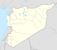
Abu Hureyra is a tell, or ancient settlement mound, in modern-day Raqqa Governorate in northern Syria. It is on a plateau near the south bank of the Euphrates, 120 kilometres (75 mi) east of Aleppo. The tell is a massive accumulation of collapsed houses, debris, and lost objects accumulated over the course of the habitation of the ancient village. The mound is nearly 500 metres (1,600 ft) across, 8 metres (26 ft) deep, and contained over 1,000,000 cubic metres (35,000,000 cu ft) of archaeological deposits. Today the tell is inaccessible, drowned beneath the waters of Lake Assad.
...
Wikipedia

