Abrantes Municipality
| Abrantes | |||
|---|---|---|---|
| Municipality | |||
 |
|||
|
|||
 |
|||
| Coordinates: 39°27′48″N 8°11′51″W / 39.46333°N 8.19750°WCoordinates: 39°27′48″N 8°11′51″W / 39.46333°N 8.19750°W | |||
| Country |
|
||
| Region | Centro | ||
| Subregion | Médio Tejo | ||
| Intermunic. comm. | Médio Tejo | ||
| District | Santarém | ||
| Parishes | 13 | ||
| Government | |||
| • President | Nélson Marques Carvalho (PS) | ||
| Area | |||
| • Total | 714.69 km2 (275.94 sq mi) | ||
| Highest elevation | 315 m (1,033 ft) | ||
| Lowest elevation | 18 m (59 ft) | ||
| Population (2011) | |||
| • Total | 39,325 | ||
| • Density | 55/km2 (140/sq mi) | ||
| Time zone | WET/WEST (UTC+0/+1) | ||
| Postal code | 2200 | ||
| Area code | 292 | ||
| Patron | São Vicente/São João | ||
| Website | http://www.cm-abrantes.pt | ||
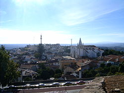
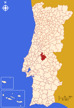
Abrantes (Portuguese pronunciation: [ɐˈβɾɐ̃tɨʃ]) is a municipality in the central Médio Tejo subregion of Portugal. The population as of 2011[update] was 39,325, in an area of 714.69 square kilometres (275.94 sq mi). The municipality includes several parishes divided by the Tagus River, which runs through the middle of the municipality. The urbanized part, the parish of Abrantes (São Vicente e São João) e Alferrarede, located on the north bank of the Tagus, has about 17,000 residents.
The Celts are believed to have established the first settlement in Abrantes around 300 BC. The name is derived from Latin Aurantes, perhaps referring to deposits of alluvial gold (Latin: ) along the Tagus. Similarly, Roman mosaics, coins, the remains of ancient aqueducts, as well as other antiquities, have been discovered in the vicinity of Abrantes.
The village of Abrantes and the Abrantes Castle were conquered from the Moors by Afonso I of Portugal in 1148. After 1172, Abrantes was a military outpost, under the dominion of the Order of Saint James of Compostela. Later, it became a distinct order, when Pope Nicholas IV (around 1290) released the Order from the jurisdiction of the Castilian grand master in Uclés. It received its municipal foral in 1179, in compensation for its resistance against the Moroccan Abem Jacob. Its creation in 1179, was based on the concelhos perfeitos ("perfect municipality") model; they were formed on the specific day that settlers were invited to populate them; the administrative regime, the organization of the municipal authority and geographic distribution were planned as part of system of populating uninhabited lands, and extending the political influence of the Kingdom. In 1173, the region, including its castle, were donated to the Order of Saint James of the Sword. Its geography contributed to the colonization:
...
Wikipedia


