A71 road
| A71 | |
|---|---|
 |
|
| Route information | |
| Length: | 70 mi (110 km) |
| Major junctions | |
| East end: |
Edinburgh 55°56′21″N 3°13′35″W / 55.9392°N 3.2265°W |
|
|
|
| West end: |
Irvine 55°36′25″N 4°39′58″W / 55.6070°N 4.6662°W |
| Location | |
|
Primary destinations: |
Edinburgh, Livingston, Strathaven, Kilmarnock |
| Road network | |
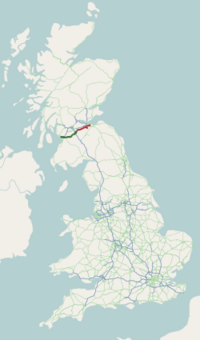
The A71 is a major road in Scotland linking Edinburgh with Lanarkshire and Ayrshire. It adjoins the Livingston Bypass A899.
It runs south west from Edinburgh for approximately 70 miles, through Saughton, Wilkieston and south of Livingston, Whitburn and Wishaw, then by way of Overtown, Garrion Bridge, Stonehouse, Strathaven, Darvel, Newmilns, Galston, Hurlford and Kilmarnock to Irvine on the North Ayrshire coast.
Formerly a trunk route from the east to the west coast of Scotland it has since been downgraded to a mix of primary and secondary routes. From Edinburgh to Darvel, it is now a secondary route,in a poor state of repair in some places. But, from Darvel to Irvine, it has retained its primary route status.
...
Wikipedia

