A38 road (England)
| A38 | |
|---|---|
 |
|

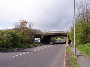
A38 passing under M50 in Worcestershire
|
|
| Major junctions | |
| South end: | Bodmin |
| North end: | Mansfield |
| Location | |
|
Primary destinations: |
Liskeard Plymouth Exeter Taunton Bridgwater Bristol Gloucester Worcester Bromsgrove Birmingham Lichfield Burton upon Trent Derby |
| Road network | |
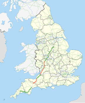
The A38, part of which is also known as the Devon Expressway, is a major A-class trunk road in England.
The road runs from Bodmin in Cornwall to Mansfield in Nottinghamshire. It is 292 miles (470 km) long, making it the longest 2-digit A road in England. It was formerly known as the Leeds–Exeter Trunk Road, when this description also included the A61. Prior to the opening of the M5 motorway in the 1960s and 1970s, the A38 formed the main "holiday route" from the Midlands to Somerset, Devon and Cornwall.
Considerable lengths of the road in the West Midlands closely follow Roman roads, including part of Icknield Street. Between Worcester and Birmingham the current A38 follows the line of a Saxon salt road; For most of the length of the M5 motorway, the A38 road runs alongside it as a single carriageway road.
The road starts on the eastern side of Bodmin at a junction with the A30 before traversing the edge of the town to meet the A30 again. It travels through the picturesque Glynn Valley to Dobwalls and Liskeard, which are bypassed by a dual carriageway. The Dobwalls section contains the most sophisticated bat bridge yet constructed in the UK. The A38 continues through the Cornish countryside, bypassing the centre of Saltash and continuing through the Saltash Tunnel. Immediately after the tunnel the River Tamar is crossed using the Tamar Bridge where the route resumes dual carriageway status. The section from Plymouth to Exeter is known locally as the Devon Expressway; it forms the southern border of Dartmoor National Park, and serves as a southward extension of the M5 motorway opening in 1977. It is 42 miles (68 km) long and was completed in the early 1970s. There are several grade separated junctions along its length mainly for local traffic; including a three-level stacked roundabout for the A386, which heads out towards Dartmoor National Park. The route was reserved for the Parkway as early as 1943, when it was included in the Plan for Plymouth. In the early 1990s, the Marsh Mills junction was significantly remodelled, reducing the size of the roundabout and building a flyover over the top of it, allowing free flowing access from the Plympton bypass onto the Parkway. The viaducts carrying the A38 over the River Plym, which after the construction of the Marsh Mills flyover became the Exeter bound sliproads, were built in 1969–70 as part of the Plympton bypass. They were replaced in the 1990s due to suffering from Alkali Silica Reaction, and the project, completed in February 1996 at a cost of £12.25million, involved the world's largest sideways bridge slide at the time for the 410 metres (1,350 ft), 5,500 tonne bridge. This required the road to be closed for only 48 hours, which won it an AA National Motoring Award in 1996 for innovation and minimisation of traffic congestion.
...
Wikipedia

