1999–00 South Pacific cyclone season
| 1999–2000 South Pacific cyclone season | |
|---|---|
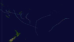
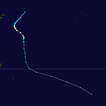
Season summary map
|
|
| Seasonal boundaries | |
| First system formed | September 5, 1999 |
| Last system dissipated | May 21, 2000 |
| Strongest storm | |
| Name | Kim |
| • Maximum winds | 165 km/h (105 mph) (10-minute sustained) |
| • Lowest pressure | 935 hPa (mbar) |
| Seasonal statistics | |
| Total disturbances | 25 |
| Total depressions | 20 |
| Tropical cyclones | 6 |
| Severe tropical cyclones | 4 |
| Total fatalities | At least 1 indirect |
| Total damage | Unknown |
| Related articles | |
| Tropical depression (Australian scale) | |
| Duration | January 3 – January 6 |
|---|---|
| Peak intensity | 45 km/h (30 mph) (10-min) 1004 hPa (mbar) |
| Category 3 severe tropical cyclone (Australian scale) | |
| Category 1 tropical cyclone (SSHWS) | |
| Duration | January 6 – January 10 |
|---|---|
| Peak intensity | 150 km/h (90 mph) (10-min) 964 hPa (mbar) |
| Tropical depression (Australian scale) | |
| Duration | January 20 – January 26 |
|---|---|
| Peak intensity | 75 km/h (45 mph) (10-min) 996 hPa (mbar) |
| Category 3 severe tropical cyclone (Australian scale) | |
| Category 1 tropical cyclone (SSHWS) | |
| Duration | January 23 – January 27 |
|---|---|
| Peak intensity | 120 km/h (75 mph) (10-min) 972 hPa (mbar) |
| Category 4 severe tropical cyclone (Australian scale) | |
| Category 3 tropical cyclone (SSHWS) | |
| Duration | February 22 – February 29 |
|---|---|
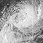
| Peak intensity | 165 km/h (105 mph) (10-min) 935 hPa (mbar) |
| Tropical depression (Australian scale) | |
| Duration | February 28 – February 29 |
|---|---|
| Peak intensity | 65 km/h (40 mph) (10-min) 994 hPa (mbar) |
| Category 2 tropical cyclone (Australian scale) | |
| Tropical storm (SSHWS) | |
| Duration | March 4 – March 8 |
|---|---|
| Peak intensity | 95 km/h (60 mph) (10-min) 985 hPa (mbar) |
| Category 3 severe tropical cyclone (Australian scale) | |
| Category 1 tropical cyclone (SSHWS) | |
| Duration | March 6 – March 11 |
|---|---|
| Peak intensity | 140 km/h (85 mph) (10-min) 960 hPa (mbar) |
| Tropical disturbance (Australian scale) | |
| Duration | March 9 – March 12 |
|---|---|
| Peak intensity | Winds not specified |
The 1999–2000 South Pacific tropical cyclone season was an event in the annual cycle of tropical cyclone formation and ran from November 1, 1999, to April 30, 2000, in the South Pacific.
It should also be noted that the regional tropical cyclone operational plan defines a "tropical cyclone year" separately from a "tropical cyclone season", with the "tropical cyclone year" for this season lasting from July 1, 1999, to June 30, 2000.
All of the six named storms affected land in some way, but no major damage was reported from any of the storms.
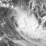
A disturbance was identified on 3 January at 0600 (UTC) near Espiritu Santo in Vanuatu. The storm was difficult to locate the general centre for the next couple of days, but on 6 January, it became more organised, while displaying midget characteristics. On 7 January at 2100 (UTC), it was named Tropical Cyclone Iris, located 330 km (205 mi) northwest of Port Vila, moving southeast. In Vila, 110 km (70 mi) away from Iris's centre, recorded winds of only up to 20 knots (37 km/h), explaining the very small size of the cyclone. Iris intensified with 10-min winds increasing to 60 knots (110 km/h) on 8 January at 1200 (UTC). JTWC's estimated 1-min winds was 65 knots (120 km/h). There were some indications that Iris could be far more intense than what the warning centres estimated, mainly due to its small size. Iris accelerated eastward, leaving Vanuatu. On 9 January, Iris began its weakening trend, while moving closer to Fiji. Iris was downgraded to a depression on 10 January, just 48 hours after it had reached its peak intensity. The final warning placed the centre on the Dateline 150 nmi (280 km) southeast of Fiji.
Fresh to strong winds and very rough seas were experienced over the western and southern parts of Fiji. Overall damage was minimal. Cyclone Iris was most notable for its rapid strengthening in its early stages, followed by its rapid decay.
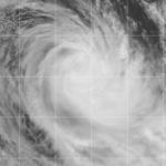
A disturbance was first identified over northern parts of Vanuatu on 19 January. It developed slowly, but deepened quickly on 22 January, and advisories were issued on the system on 23 January. It moved southward and was upgraded to Tropical Cyclone Jo on 24 January at 0300 (UTC). Jo moved to the south-east and attained storm force winds 15 hours after being named. The cyclone reached its peak intensity on 26 January at 0000 (UTC) located 650 km (400 mi) south of Nadi, with 10-min average winds of 60 knots (110 km/h). JTWC's peak 1-min average winds were 65 knots (120 km/h). Jo moved further to the south-east, and moved close enough to affect Fiji. Gusts to 50 knots (93 km/h) were recorded on Viti Levu on Fiji, even though Jo was about 445 km (275 mi) away from the Fiji. Flash flooding was reported, but there was no major river flooding. Cyclone Jo was declared extratropical on 28 January at 0600 (UTC) when located more than 1,000 nmi (1,900 km) east of North Island in New Zealand.
...
Wikipedia


