1663 Charlevoix earthquake
| Date | February 5, 1663 |
|---|---|
| Magnitude | 7.3–7.9 Mw |
| Epicenter | 47°36′N 70°06′W / 47.6°N 70.1°WCoordinates: 47°36′N 70°06′W / 47.6°N 70.1°W |
| Areas affected |
New France British America |
| Max. intensity | X (Extreme) |
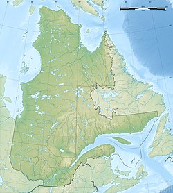
The 1663 Charlevoix earthquake occurred on February 5 in New France (now the Canadian province of Quebec), and was assessed to have a moment magnitude of between 7.3 and 7.9. The earthquake occurred at 5:30 p.m. local time and was estimated to have a maximum perceived intensity of X (Extreme) on the Mercalli intensity scale. The main shock epicentre is suggested to have occurred along the Saint Lawrence River, between the mouth of the Malbaie River on the north and the mouth of the Ouelle River on the south. A large portion of eastern North America felt the effects. Landslides and underwater sediment slumps were a primary characteristic of the event with much of the destruction occurring near the epicentral region of the St. Lawrence estuary and also in the area of the Saguenay Graben.
The event occurred during the early European settlement of North America and some of the best recorded first hand accounts were from Catholic missionaries that were working in the area. These records were scrutinized to help determine the scale of damage and estimate the magnitude of the quake in the absence of abundant records from that time period.
The Charlevoix Seismic Zone (CSZ) lies along the St.Lawrence River, northeast of Quebec City. Although eastern Canada has relatively infrequent earthquakes, due to its location away from active plate boundaries, the CSZ is its most active part, with five earthquakes of estimated magnitude of 6 or greater since historical records began. Focal mechanisms for earthquakes in this zone are consistent with rupture on both reverse faults and strike-slip faults of varied orientation. The main structures of the area are faults of the Saint Lawrence rift system that run parallel to the river, formed during the break-up of the supercontinent Rodinia in the late Neoproterozoic and early Paleozoic. The greatest seismicity occurs where the rift is overprinted by a ~300 Ma meteorite crater, the Charlevoix impact structure. Most CSZ earthquakes have hypocenters within the Grenvillian basement at depths between 7 and 15 km. Many of the smaller earthquakes do not appear to be located on the rift faults, but within the volumes of rock between them. Larger events lie outside the impact structure and have inferred nodal planes consistent with reactivation of the rift faults. The relatively weak impact structure is interpreted to cause a perturbation of the regional stress field, affecting the stability of the rift faults.
...
Wikipedia

