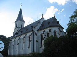
Ždírec (Jihlava District)
| Ždírec | |||
|---|---|---|---|
| Municipality | |||
 |
|||
|
|||
| Coordinates: 49°27′12″N 15°40′50″E / 49.45333°N 15.68056°ECoordinates: 49°27′12″N 15°40′50″E / 49.45333°N 15.68056°E | |||
| Country |
|
||
| Region | Vysočina | ||
| District | Jihlava | ||
| Area | |||
| • Total | 10.35 km2 (4.00 sq mi) | ||
| Elevation | 515 m (1,690 ft) | ||
| Population (2011) | |||
| • Total | 405 | ||
| • Density | 39/km2 (100/sq mi) | ||
| Postal code | 588 13 | ||
| Website | http://www.obeczdirec.cz | ||
Ždírec (German Seelenz) is a village situated in Vysočina Region of the Czech Republic. The municipality covers an area of 10.35 square kilometres (4.00 sq mi) and has a population of 405 (as at 26 March 2011). Ždírec lies approximately 10 kilometres north-east of Jihlava and 4.5 kilometres south-west of Polná.
The first historical reference comes from 1233, but the village is probably older. From the 13th century to the Second World War Ždírec was a German village. After the expulsion of Germans from Czechoslovakia the village was settled by Czechs.
The name of the village comes from the word žďáření (slash-and-burn).
Ždírec has a small shop, a restaurant, a library, a nursery, a retirement home, a multipurpose building and a football field. The village has had its own flag and coat of arms since 2008.
...
Wikipedia


