Šumava
| Bohemian Forest | |
|---|---|
| Böhmerwald (German) Šumava (Czech) |
|

Großer Arber (Velký Javor)
|
|
| Highest point | |
| Peak | Großer Arber |
| Elevation | 1,456 m (4,777 ft) |
| Dimensions | |
| Length | 100 km (62 mi) |
| Geography | |
| Countries | Germany, Czech Republic and Austria |
| Range coordinates | 49°06′45″N 13°08′09″E / 49.1125°N 13.1359°ECoordinates: 49°06′45″N 13°08′09″E / 49.1125°N 13.1359°E |
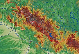
The Bohemian Forest, known in Czech as Šumava (pronounced [ˈʃʊmava]) and in German as Böhmerwald, is a low mountain range in Central Europe. Geographically, the mountains extend from Plzeň Region and South Bohemia in the Czech Republic to Austria and Bavaria in Germany, and form the highest truncated uplands of the Bohemian Massif, up to 50 km wide. They create a natural border between the Czech Republic on one side and Germany and Austria on the other.
For political reasons, the Bohemian and German sides have different names: in Czech, the Bohemian side is called Šumava and the Bavarian side Zadní Bavorský les (English: rear Bavarian Forest), while in German, the Bohemian side is called Böhmerwald (English: Bohemian Forest), and the Bavarian side Bayerischer Wald (English: Bavarian Forest).
In Czech, Šumava is also used as a name for the entire adjacent region in Bohemia.
The Bohemian Forest comprises heavily forested mountains with average heights of 800–1,400 metres. The highest peak is Großer Arber (1,456 m) on the Bavarian side; the highest peak on the Bohemian and Austrian side is Plechý (Plöckenstein) (1,378 m). The most eastern peak is the Sternstein (1,125m). The range is one of the oldest in Europe, and its mountains are eroded into round forms with few rocky parts. Typical for the Bohemian Forest are plateaux at about 1,000–1,200 m with relatively harsh climates and many peat bogs.
...
Wikipedia

