Ōsaki, Miyagi
|
Ōsaki 大崎市 |
|||
|---|---|---|---|
| City | |||

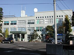
Ōsaki City Hall
|
|||
|
|||
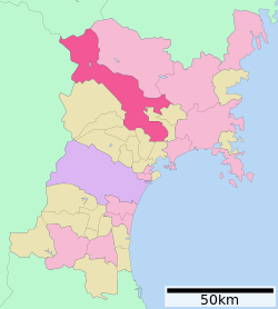
 Location of Ōsaki in Miyagi Prefecture |
|||
| Coordinates: 38°34′37.6″N 140°57′20.1″E / 38.577111°N 140.955583°ECoordinates: 38°34′37.6″N 140°57′20.1″E / 38.577111°N 140.955583°E | |||
| Country | Japan | ||
| Region | Tōhoku | ||
| Prefecture | Miyagi | ||
| Government | |||
| • -Mayor | Yasushi Ito | ||
| Area | |||
| • Total | 796.76 km2 (307.63 sq mi) | ||
| Population (September 2015) | |||
| • Total | 132,930 | ||
| • Density | 167/km2 (430/sq mi) | ||
| Time zone | Japan Standard Time (UTC+9) | ||
| - Tree | Rose | ||
| - Flower | Flowering Dogwood | ||
| Phone number | 0229-23-2111 | ||
| Address | 1-1 Furukawa Nanokamachi, Ōsaki-shi, Miyagi-ken 989-6188 | ||
| Website | Official website | ||
Ōsaki (大崎市 Ōsaki-shi?) is a city located in Miyagi Prefecture, in the Tohoku region of northern Japan. As of September 2015, the city had an estimated population of 132,930 and a population density of 167 persons per km². The total area was 796.76 square kilometres (307.63 sq mi).
Ōsaki is in north-central Miyagi Prefecture.
The area of present-day Ōsaki was part of ancient Mutsu Province, and has been settled since at least the Jomon period by the Emishi people. During the Nara period, gold was discovered in the area. During later portion of the Heian period, the area was ruled by the Northern Fujiwara. During the Sengoku period, the area was contested by various samurai clans before the area came under the control of the Date clan of Sendai Domain during the Edo period, under the Tokugawa shogunate.
The town of Furukawa was established with the creation of the municipalities system on April 1, 1889. It was raised to city status on December 15, 1950.
The modern city of Ōsaki was established on March 31, 2006, from the merger of the city of Furukawa absorbed the towns of Iwadeyama and Naruko (both from Tamatsukuri District), the towns of Kashimadai, Matsuyama and Sanbongi (all from Shida District), and the town of Tajiri (from Tōda District).
...
Wikipedia


