Ōgata, Akita
|
Ōgata 大潟村 |
|||
|---|---|---|---|
| Village | |||

Ōgata City Hall
|
|||
|
|||
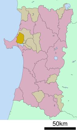
 Location of Ōgata in Akita Prefecture |
|||
| Location of Ōgata in Akita Prefecture | |||
| Coordinates: 40°1′4.1″N 139°57′35.8″E / 40.017806°N 139.959944°ECoordinates: 40°1′4.1″N 139°57′35.8″E / 40.017806°N 139.959944°E | |||
| Country | Japan | ||
| Region | Tōhoku | ||
| Prefecture | Akita Prefecture | ||
| District | Minamiakita | ||
| Government | |||
| • -Mayor | Hiroto Takahashi | ||
| Area | |||
| • Total | 170.11 km2 (65.68 sq mi) | ||
| Population (May 2015) | |||
| • Total | 3,108 | ||
| • Density | 18.3/km2 (47/sq mi) | ||
| Time zone | Japan Standard Time (UTC+9) | ||
| - Tree | Japanese Black Pine | ||
| - Flower | Scarlet Sage | ||
| - Bird | Swan | ||
| Phone number | 0185-45-2111 | ||
| Address | 1-1 Chūō, Ōgata-mura, Minamiakita-gun, Akita-ken 010-0494 | ||
| Website | www |
||
Ōgata (大潟村 Ōgata-mura?) is a village located in Minamiakita District, Akita Prefecture, in the northern Tohoku region of Japan. As of May 2015, the village had an estimated population of 3,108 and a population density 18.3 persons per km². The total area was 170.11 square kilometres (65.68 sq mi).
The village is known internationally for its Solarcar Rally and Eco car races.
The NHK Ōgata Transmitter is located in the village. It is used for transmissions on 774 kHz with a power of 500 kW.
Ōgata is located northwestern Akita Prefecture. The village consists entirely of land reclaimed from the former Lake Hachirōgata, and as a consequence is flat, and mostly below sea level.
Land reclamation work began at Lake Hachirōgata in April 1957. The new village of Ōgata was formally established on October 1, 1964, with the first settlers arriving in November 1967.
The economy of Ōgata is based on agriculture.
Ōgata is not served by any railways or highways.
...
Wikipedia


