Îles Saint-Marcouf
| Îles Saint-Marcouf | |
|---|---|

Îles Saint-Marcouf from the beach at Ravenoville
|
|
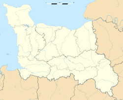
| Location in Lower Normandy | |
| Coordinates: 49°29′45″N 1°09′00″W / 49.49583°N 1.15000°W |
Îles Saint-Marcouf are a group of two small uninhabited islands off the coast of Normandy, France. They lie in the Baie de la Seine region of the English Channel and are 6.5 km (4.0 mi) east of the coast of the Cotentin peninsula at Ravenoville and 13 km (8 mi) from the island of Tatihou and the harbour at Saint-Vaast-la-Hougue. In addition to the fortifications described below, on the larger island there is a lighthouse that dates to 1948.
The larger island, île du Large, is 500 metres (1,600 ft) east of the smaller île de Terre. They have a total area of 1,400 hectares (3,500 acres) and a maximum altitude of 10 metres (33 ft).
The islands take their name from Saint Marcouf, a saint born in Bayeux, whom it was said could cure anyone of scrofula. He died on the Îles Saint-Marcouf on 1 May 588 CE. There was a monastic presence on the islands until the 15th century.
During the French Revolutionary Wars the Royal Navy held the islands for nearly seven years as a strategic forward base. In July 1795 British sailors and marines from the Western Frigate Squadron under the command of Captain Sir Sidney Smith in Diamond occupied the islands. Smith dedicated several gunvessels, including Badger, Hawke, Shark, and Sandfly, the latter purpose-built for the role, to provide materials and manpower for fortifying the islands and establishing a naval garrison. Royal Engineers helped construct redoubts and shore batteries that detachments of marines and Royal Artillery, who augmented the sailors, helped man. In December 1795 the crew of Shark mutinied, in part because of the harsh conditions on the islands, and handed her over to the French.
...
Wikipedia

