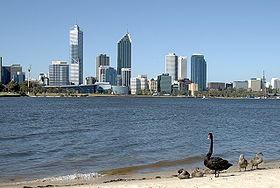
Swan River, Western Australia
| Swan (Noongar: Derbarl Yerrigan) | |
| River | |
| Country | Australia |
|---|---|
| State | Western Australia |
| Tributaries | |
| - left | Susannah Brook, Jane Brook |
| - right | Ellen Brook, Helena River, Bennett Brook, Canning River |
| City | Perth; Fremantle |
| Source confluence | Avon River with Wooroloo Brook |
| - location | below Mount Mambup |
| - elevation | 53 m (174 ft) |
| - coordinates | 31°44′34″S 116°4′3″E / 31.74278°S 116.06750°E |
| Mouth | Indian Ocean |
| - location | Fremantle |
| - elevation | 0 m (0 ft) |
| - coordinates | 32°4′25″S 115°42′52″E / 32.07361°S 115.71444°ECoordinates: 32°4′25″S 115°42′52″E / 32.07361°S 115.71444°E |
| Length | 72 km (45 mi) |
| Width | 4 km (2 mi) |
| Basin | 121,000 km2 (46,718 sq mi) |
|
Map of the area around Perth, showing the location of the Swan River
|
|
The Swan River is a river in the south west of Western Australia. Its Aboriginal Noongar name is the Derbarl Yerrigan. The river runs through the metropolitan area of Perth, Western Australia's capital and largest city.
The Swan River estuary flows through the city of Perth. Its lower reaches are relatively wide and deep, with few constrictions, while the upper reaches are usually quite narrow and shallow.
The Swan River drains the Avon and coastal plain catchments, which have a total area of about 121,000 square kilometres (47,000 sq mi). It has three major tributaries, the Avon River, Canning River and Helena River. The latter two have dams (Canning Dam and Mundaring Weir) which provide a sizeable part of the potable water requirements for Perth and the regions surrounding. The Avon River contributes the majority of the freshwater flow. The climate of the catchment is Mediterranean, with mild wet winters, hot dry summers, and the associated highly seasonal rainfall and flow regime.
The Avon rises near Yealering, 100 kilometres (62 mi) southeast of Perth: it meanders north-northwest to Toodyay about 90 kilometres (56 mi) northeast of Perth, then turns southwest in Walyunga National Park – at the confluence of the Wooroloo Brook, it becomes the Swan River.
The Canning River rises not far from North Bannister, 100 kilometres (62 mi) southeast of Perth and joins the Swan at Applecross, opening into Melville Water. The river then narrows into Blackwall Reach, a narrow and deep stretch leading the river through Fremantle Harbour to the sea.
...
Wikipedia


