Lebanon, Illinois
| Lebanon | |
| City | |
| Country | United States |
|---|---|
| State | Illinois |
| County | St. Clair |
| Coordinates | 38°36′12″N 89°48′41″W / 38.60333°N 89.81139°WCoordinates: 38°36′12″N 89°48′41″W / 38.60333°N 89.81139°W |
| Area | 2.47 sq mi (6 km2) |
| - land | 2.46 sq mi (6 km2) |
| - water | 0.01 sq mi (0 km2) |
| Population | 4,418 (2010) |
| Density | 1,641.4/sq mi (634/km2) |
| Timezone | CST (UTC-6) |
| - summer (DST) | CDT (UTC-5) |
| Postal code | 62254 |
| Area code | 618 |
|
Location in St. Clair County and the state of Illinois.
|
|
|
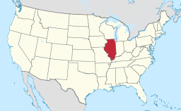
Location of Illinois in the United States
|
|
|
Website: www |
|
Lebanon is a city in St. Clair County, Illinois, United States. The population was 5,523 at the 2010 census. Like many other places in "Little Egypt" or Southern Illinois, Lebanon was named after the Middle Eastern country of the same name. It is a part of the Metro-East region of the Greater St. Louis metropolitan area.
Lebanon is home to McKendree University, the oldest college in Illinois.
Lebanon is located at 38°36′12″N 89°48′41″W / 38.60333°N 89.81139°W (38.603398, -89.811271).
According to the 2010 census, Lebanon has a total area of 2.474 square miles (6.41 km2), of which 2.46 square miles (6.37 km2) (or 99.43%) is land and 0.014 square miles (0.04 km2) (or 0.57%) is water.
As of the census of 2010, there were 5,523 people, 2,275 households, and 804 families residing in the city. The population density was 1,641.4 people per square mile (632.7/km²). There were 1,389 housing units at an average density of 647.2 per square mile (249.4/km²). The racial makeup of the city was 78.46% White, 18.45% African American, 0.34% Native American, 0.48% Asian, 0.09% Pacific Islander, 0.40% from other races, and 1.79% from two or more races. Hispanic or Latino of any race were 1.53% of the population.
...
Wikipedia


