Haleakalā
| Haleakalā | |
|---|---|
| East Maui Volcano | |

Haleakalā crater
|
|
| Highest point | |
| Elevation | 10,023 ft (3,055 m) |
| Prominence | 10,023 ft (3,055 m) |
| Isolation | 123 kilometres (76 mi) |
| Listing | |
| Coordinates | 20°42′35″N 156°15′12″W / 20.70972°N 156.25333°WCoordinates: 20°42′35″N 156°15′12″W / 20.70972°N 156.25333°W |
| Geography | |
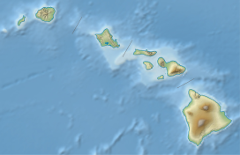
| Location | Maui, Hawaii, U.S. |
| Parent range | Hawaiian Islands |
| Topo map | USGS Kilohana (HI) |
| Geology | |
| Age of rock | <1.0 Ma, |
| Mountain type | Shield volcano |
| Volcanic arc/belt | Hawaiian-Emperor seamount chain |
| Last eruption | between 1480 and 1600 |
| Climbing | |
| Easiest route | paved highway |
Haleakalā (/ˌhɑːliːˌɑːkəˈlɑː/; Hawaiian: [ˈhɐlɛˈjɐkəˈlaː]), or the East Maui Volcano, is a massive shield volcano that forms more than 75% of the Hawaiian Island of Maui. The western 25% of the island is formed by another volcano, Mauna Kahalawai, also referred to as the West Maui Mountains.
The tallest peak of Haleakalā ("house of the sun"), at 10,023 feet (3,055 m), is Puʻu ʻUlaʻula (Red Hill). From the summit one looks down into a massive depression some 11.25 km (7 mi) across, 3.2 km (2 mi) wide, and nearly 800 m (2,600 ft) deep. The surrounding walls are steep and the interior mostly barren-looking with a scattering of volcanic cones.
Early Hawaiians applied the name Haleakalā ("house of the sun") to the general mountain. Haleakalā is also the name of a peak on the southwestern edge of Kaupō Gap. In Hawaiian folklore, the depression (crater) at the summit of Haleakalā was home to the grandmother of the demigod Māui. According to the legend, Māui's grandmother helped him capture the sun and force it to slow its journey across the sky in order to lengthen the day.
According to the United States Geological Survey USGS Volcano Warning Scheme for the United States, the Volcano Alert Level for Haleakala as of August 2015 was "normal". A Normal status is used to designate typical volcanic activity in a non-eruptive phase. Haleakala has produced numerous eruptions in the last 30,000 years, including in the last 500 years. This volcanic activity has been along two rift zones: the southwest and east. These two rift zones together form an arc that extends from La Perouse Bay on the southwest, through the Haleakalā Crater, and to Hāna to the east. The east rift zone continues under the ocean beyond the east coast of Maui as Haleakalā Ridge, making the combined rift zones one of the longest in the Hawaiian Islands chain.
...
Wikipedia

