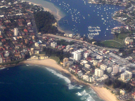
Cronulla, New South Wales
|
Cronulla Sydney, New South Wales |
|||||||||||||
|---|---|---|---|---|---|---|---|---|---|---|---|---|---|

Cronulla, New South Wales
|
|||||||||||||
| Population | 17,042 (2011 census) | ||||||||||||
| Established | 1908 | ||||||||||||
| Postcode(s) | 2230 | ||||||||||||
| Location | 26 km (16 mi) south of Sydney CBD | ||||||||||||
| LGA(s) | Sutherland Shire | ||||||||||||
| State electorate(s) | Cronulla | ||||||||||||
| Federal Division(s) | Cook | ||||||||||||
|
|||||||||||||
Cronulla is a beachside suburb, in Sydney, in the state of New South Wales, Australia. Cronulla is located 26 kilometres south of the Sydney central business district, in the local government area of the Sutherland Shire.
Cronulla is located on a peninsula framed by Botany Bay to the north, Bate Bay to the east, Port Hacking to the south, and Gunnamatta Bay to the west. The neighbouring suburb of Woolooware lies to the west of Cronulla, and Burraneer lies to the southwest. The Kurnell peninsula, the site of the first landfall on the eastern coastline made by Lt. (later Captain) James Cook in 1770, is reached by driving northeast out of Cronulla on Captain Cook Drive.
Cronulla is derived from kurranulla, meaning ‘‘place of the pink seashells’’ in the dialect of the area's Aboriginal inhabitants, the Gweagal, who were a clan of the Tharawal (or Dharawal) tribe of Indigenous Australians. They were the traditional custodians of the southern geographic areas of Sydney. The beaches were named by Surveyor Robert Dixon who surveyed here in 1827-28 and, by 1840, the main beach was still known as Karranulla. In July 1852 the schooner Venus was wrecked on the beach, which was referred to in newspaper reports as Cooranulla.
...
Wikipedia
