Zamboanga International Airport
|
Zamboanga International Airport Aeropuerto Internacional de Zamboanga Paliparang Pandaigdig ng Zamboanga |
|||||||||||
|---|---|---|---|---|---|---|---|---|---|---|---|

Facade of Zamboanga International Airport Terminal
|
|||||||||||
| Summary | |||||||||||
| Airport type | Military/Public | ||||||||||
| Operator | Civil Aviation Authority of the Philippines | ||||||||||
| Serves | Zamboanga City | ||||||||||
| Location | Moret Field, Barangay Canelar, Zamboanga City | ||||||||||
| Hub for |
Aero Majestic Airways PAL Express |
||||||||||
| Elevation AMSL | 6 m / 20 ft | ||||||||||
| Coordinates | 06°55′21″N 122°03′35″E / 6.92250°N 122.05972°ECoordinates: 06°55′21″N 122°03′35″E / 6.92250°N 122.05972°E | ||||||||||
| Website | zamboangainternational |
||||||||||
| Map | |||||||||||
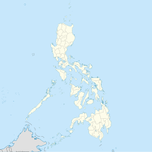
| Location in the Philippines | |||||||||||
| Runways | |||||||||||
|
|||||||||||
| Statistics (2016) | |||||||||||
|
|||||||||||
| Passengers | 980,476 |
|---|---|
| Aircraft movements (2012) | 17,290 |
| Metric tonnes of cargo (2012) | 10,801.92 |
Zamboanga International Airport (Spanish, Chavacano: Aeropuerto Internacional de Zamboanga; Filipino: Paliparang Pandaigdig ng Zamboanga) (IATA: ZAM, ICAO: RPMZ) is the main airport serving Zamboanga City in the Philippines. The airport is Mindanao's third-busiest airport after Francisco Bangoy International Airport in Davao City and Lumbia Airport in Cagayan de Oro City. The airport covers a total land area of 270 hectares.
The airport is officially classified as an international airport by the Civil Aviation Authority of the Philippines, despite only offering scheduled domestic passenger services. This is the same agency that runs not only Zamboanga International Airport, but all other airports in the Philippines except the major international airports.
The airport started off as Moret Field, an American airfield that was constructed from a rather poor Japanese airfield just north of Zamboanga. Construction was started by Philippine Commonwealth troops just after American forces landed at the present location on March 15, 1945. It was improved by a U.S. Army airfield construction unit using considerable Filipino labor. When completed, the single runway was about 4,500 feet long aligned SW to NE. There were two adjacent taxiways along both sides of the runway with revetment areas. At the peak of operations in 1945, there were about 300 aircraft flying from the airfield. The vast majority were United States Marine Corps aircraft from Marine Aircraft Group 24 which were supporting U.S. Army infantry operations on Mindanao but also ranging down the Sulu area as far as Borneo.
...
Wikipedia

