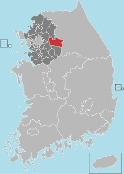
Yangpyeong County
|
Yangpyeong 양평군 |
||
|---|---|---|
| County | ||
| Korean transcription(s) | ||
| • Hangul | ||
| • Hanja | ||
| • Revised Romanization | Yangpyeong-gun | |
| • McCune-Reischauer | Yangp'yŏng kun | |
|
||
 Location in South Korea |
||
| Country |
|
|
| Region | Sudogwon | |
| Administrative divisions | 1 eup, 11 myeon | |
| Area | ||
| • Total | 877.76 km2 (338.91 sq mi) | |
| Population (September 2016) | ||
| • Total | 112,577 | |
| • Density | 128.26/km2 (332.2/sq mi) | |
| • Dialect | Seoul | |
| Yangpyeong | ||||||||||||||||||||||||||||||||||||||||||||||||||||||||||||
|---|---|---|---|---|---|---|---|---|---|---|---|---|---|---|---|---|---|---|---|---|---|---|---|---|---|---|---|---|---|---|---|---|---|---|---|---|---|---|---|---|---|---|---|---|---|---|---|---|---|---|---|---|---|---|---|---|---|---|---|---|
| Climate chart () | ||||||||||||||||||||||||||||||||||||||||||||||||||||||||||||
|
||||||||||||||||||||||||||||||||||||||||||||||||||||||||||||
|
||||||||||||||||||||||||||||||||||||||||||||||||||||||||||||
| J | F | M | A | M | J | J | A | S | O | N | D |
|
21
2
−9
|
28
6
−6
|
45
12
−1
|
72
19
5
|
102
24
11
|
156
28
17
|
429
29
21
|
350
30
21
|
181
26
16
|
41
20
8
|
38
12
0
|
17
5
−6
|
| Average max. and min. temperatures in °C | |||||||||||
| Precipitation totals in mm | |||||||||||
| Source: Korea Meteorological Administration | |||||||||||
| Imperial conversion | |||||||||||
|---|---|---|---|---|---|---|---|---|---|---|---|
| J | F | M | A | M | J | J | A | S | O | N | D |
|
0.8
36
17
|
1.1
42
21
|
1.8
53
31
|
2.8
67
41
|
4
76
52
|
6.1
83
62
|
17
85
70
|
14
86
70
|
7.1
80
60
|
1.6
69
46
|
1.5
53
33
|
0.7
40
21
|
| Average max. and min. temperatures in °F | |||||||||||
| Precipitation totals in inches | |||||||||||
Yangpyeong County (Yangpyeong-gun) is a county in Gyeonggi Province, South Korea.
Yangpyeong includes the village of Jipyeong, which was a Korean War battle site.
Lee Soo-geun — is a South Korean comedian
Coordinates: 37°29′N 127°33′E / 37.483°N 127.550°E
...
Wikipedia

