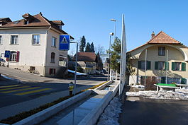
Wyssachen
| Wyssachen | ||
|---|---|---|
 |
||
|
||
| Coordinates: 47°5′N 7°50′E / 47.083°N 7.833°ECoordinates: 47°5′N 7°50′E / 47.083°N 7.833°E | ||
| Country | Switzerland | |
| Canton | Bern | |
| District | Oberaargau | |
| Government | ||
| • Mayor | Hanspeter Baltensberger | |
| Area | ||
| • Total | 11.7 km2 (4.5 sq mi) | |
| Elevation | 707 m (2,320 ft) | |
| Population (Dec 2015) | ||
| • Total | 1,169 | |
| • Density | 100/km2 (260/sq mi) | |
| Postal code | 4954 | |
| SFOS number | 0960 | |
| Surrounded by | Dürrenroth, Eriswil, Huttwil, Sumiswald | |
| Website |
www SFSO statistics |
|
Wyssachen is a municipality in the Oberaargau administrative district in the Swiss canton of Bern.
Wyssachen is first mentioned in 1349 as Wissachon. Until 1908 it was officially known as Wyssachengraben or Grabengemeinde.
For much of its history, Wyssachen was part of the parish and municipality of Eriswil. In 1516 Eriswil became part of the Bernese district of Trachselwald. In 1755 Wyssachen began to care for the local poor independently of Eriswil. In 1796 they expanded their charitable operations and became increasingly independent of Eriswil. Finally in 1847 Wyssachen became an independent political municipality. The 334 inhabitants of Neuligen and Schwendi left Wyssachen to become part of Eriswil in 1888. A village church was built in 1946 and twenty years later became the parish church of the Wyssachen parish.
Wyssachen has an area of 11.7 km2 (4.52 sq mi). As of the 2006 survey, a total of 8.3 km2 (3.2 sq mi) or 70.9% is used for agricultural purposes, while 2.64 km2 (1.02 sq mi) or 22.6% is forested. Of rest of the municipality 0.78 km2 (0.30 sq mi) or 6.7% is settled (buildings or roads), 0.03 km2 (7.4 acres) or 0.3% is either rivers or lakes and 0.01 km2 (2.5 acres) or 0.1% is unproductive land.
From the same survey, housing and buildings made up 4.0% and transportation infrastructure made up 1.9%. A total of 19.2% of the total land area is heavily forested and 3.3% is covered with orchards or small clusters of trees. Of the agricultural land, 19.5% is used for growing crops and 49.2% is pasturage, while 2.2% is used for orchards or vine crops. All the water in the municipality is flowing water.
Originally consisting of scattered farm houses without a true village center, in the last century the village school house and surrounding buildings have become the municipal core. In addition to the new village center, the remainder of the residents live in scattered farm houses or farm house clusters.
On 31 December 2009 Amtsbezirk Trachselwald, the municipality's former district, was dissolved. On the following day, 1 January 2010, it joined the newly created Verwaltungskreis Oberaargau.
...
Wikipedia


