Wortwell
| Wortwell | |
|---|---|
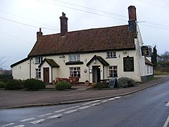
 Wortwell Village Pub |
|
| Wortwell shown within Norfolk | |
| Area | 4.6 km2 (1.8 sq mi) |
| Population | 561 (2011) |
| • Density | 122/km2 (320/sq mi) |
| OS grid reference | TM276848 |
| Civil parish |
|
| District | |
| Shire county | |
| Region | |
| Country | England |
| Sovereign state | United Kingdom |
| Post town | HARLESTON |
| Postcode district | IP20 |
| Police | Norfolk |
| Fire | Norfolk |
| Ambulance | East of England |
| EU Parliament | East of England |
Wortwell is a village and civil parish in the English county of Norfolk and adjoining the county of Suffolk. It is located on both the River Waveney (which forms the county boundary) and the A143 road, some 20 km east of Diss and 30 km west of Lowestoft. The city of Norwich lies approximately 30 km to the north.
The civil parish has an area of 4.6 km2 (1.8 sq mi) and in the 2001 census had a population of 574 in 243 households, the population decreasing to 561 at the 2011 census. For the purposes of local government, the parish falls within the district of South Norfolk.
The village of Wortwell is one of the few in Norfolk not to be listed in the Domesday Book. Until the end of the 19th century Wortwell was a hamlet within the parish of Mendham-in-Norfolk, (the modern village of Mendham is south of the River Waveney in Suffolk) becoming a parish in the 1885 boundary alterations.
Ezekiel Blomfield (1778–1818), a Congregational minister, author and compiler of religious works and works on natural history, was buried on 21 July 1818 in the grounds of the Meeting House at Wortwell.
Wortwell has a well established football club with its two football teams currently play in the Anglian Combination Football League, the first team playing in division 2 and the reserves playing in division 6. Playing home games at the rec at Wortwell community centre village hall.
...
Wikipedia

