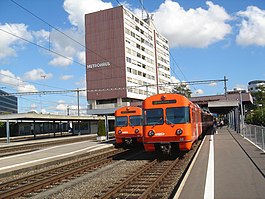
Worblaufen
| Ittigen | ||
|---|---|---|
 |
||
|
||
| Coordinates: 46°59′N 7°29′E / 46.983°N 7.483°ECoordinates: 46°59′N 7°29′E / 46.983°N 7.483°E | ||
| Country | Switzerland | |
| Canton | Bern | |
| District | Bern-Mittelland | |
| Government | ||
| • Executive |
Gemeinderat with 7 members |
|
| • Mayor | Gemeindepräsident | |
| Area | ||
| • Total | 4.21 km2 (1.63 sq mi) | |
| Elevation | 526 m (1,726 ft) | |
| Population (Dec 2015) | ||
| • Total | 11,390 | |
| • Density | 2,700/km2 (7,000/sq mi) | |
| Postal code | 3063 | |
| SFOS number | 0362 | |
| Surrounded by | Bern, Bolligen, Moosseedorf, Münchenbuchsee, Ostermundigen, Zollikofen | |
| Twin towns | Dobrusch (Belarus) | |
| Website |
www SFSO statistics |
|
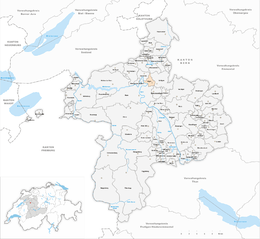
Ittigen is a municipality in the Bern-Mittelland administrative district in the canton of Bern in Switzerland.
The municipality was formed in 1983 when it and Ostermundigen were separated from territory once part of Bolligen.
Its placename is derived from the Alemannic German "at the people of the Ito", and first appeared in print in 1318 as Yttigen. In 1326 it was mentioned as villa de Ittigen.
Traces of prehistoric settlements have been found at Worblaufen (La Tene vessel with cremated remains, Roman coins and Early Medieval graves), in the Papiermühle neighborhood (5th or 6th century Early Medieval cemetery with about 30 graves), Neuhaus (Early Medieval graves) and in Wydacker (Seax).
While the small hamlets of Papiermühle, Schermen, Neuhaus, Badhaus developed on the valley floor, the farming villages of Ittigen and Worblaufen grew up on terraces in the low mountains above the valley. The two farming villages took advantage of extensive arable land for individual fields and shared common farm land and common forests. A number of scattered small farms grew up around the two villages and also had a share of the common land. While the villages in the mountains remained mostly agricultural, the hamlets on the valley floor were local centers for trade and industry. A paper mill (German: Papiermühle) opened in Papiermühle in 1466, followed by a toll house and an inn. There was also a mill at Schermen, a toll house and inn in Neuhaus and a 15th-century spa and inn in Badhaus. A paper mill and several hammer mills eventually opened in Worblaufen. Around the 17th and 18th centuries, the agricultural villages focused on providing fruits, vegetables and hay for the weekly markets in the nearby city of Bern. The area's sunny weather and proximity to Bern encouraged several wealthy families to build country estates in Ittigen including Mannenberg in Ittigen village and Sandhof and Lindenhof in Worblaufen. In the 19th century, agriculture remained important, but small workshops and cottage industry work provided jobs for many of the residents. A pasta factory opened in Schermen in 1831 followed by a chocolate factory in 1917.
...
Wikipedia


