Wolstonbury Hill
| Site of Special Scientific Interest | |
 |
|
| Area of Search | West Sussex |
|---|---|
| Grid reference | TQ282140 |
| Coordinates | 50°54′40″N 0°10′32″W / 50.911099°N 0.175532°WCoordinates: 50°54′40″N 0°10′32″W / 50.911099°N 0.175532°W |
| Interest | Biological |
| Area | 58.6 ha (145 acres) |
| Notification | 1954 |
| Natural England website | |
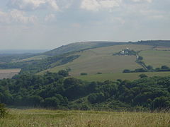
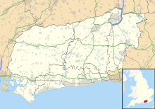
Wolstonbury Hill is a chalk prominence in the South Downs National Park, approximately 4 kilometres (2.5 mi) north of Brighton and 1.6 kilometres (0.99 mi) west of Clayton, in the parish of Pyecombe, West Sussex, England. It lies just to the south of Hurstpierpoint, a village mentioned in the Domesday Book of 1085.
Rising to a maximum height of 225 metres (738 ft), Wolstonbury projects into the Weald from the main ridge of the South Downs giving views of both the Downs and the Weald. Views across the Weald to the north are panoramic, to the east are the Clayton Windmills and Ditchling Beacon beyond. Hollingbury is prominent to the southeast. Looking west one can see Newtimber Hill, West Hill with Devils Dyke just beyond, further out Chanctonbury Ring is clearly visible.
Wolstonbury, owned and maintained by the National Trust, is listed as a Scheduled Monument.
No roads or car parks lie close to the summit so visitors have to ascend on foot or by mountain bike.
South of Hurstpierpoint ridge, the clay vale lies beneath the jutting profile and complex scarp and foot of Wolstonbury Hill.
The approach from the north is characterised by a network of linked or closely spaced woodlands (some parts ancient) centred on the designed landscape at Danny House.
...
Wikipedia

