Winona Municipal Airport
|
Winona Municipal Airport Max Conrad Field |
|||||||||||||||
|---|---|---|---|---|---|---|---|---|---|---|---|---|---|---|---|
 |
|||||||||||||||
| Summary | |||||||||||||||
| Airport type | Public | ||||||||||||||
| Operator | City of Winona | ||||||||||||||
| Location | Winona, Minnesota | ||||||||||||||
| Elevation AMSL | 656 ft / 199.9 m | ||||||||||||||
| Coordinates | 44°04′38″N 91°42′30″W / 44.07722°N 91.70833°WCoordinates: 44°04′38″N 91°42′30″W / 44.07722°N 91.70833°W | ||||||||||||||
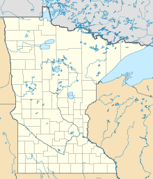
| Map | |||||||||||||||
| Location of airport in Minnesota / United States | |||||||||||||||
| Runways | |||||||||||||||
|
|||||||||||||||
| Statistics | |||||||||||||||
|
|||||||||||||||
| Aircraft operations (2016) | 10,450 |
|---|---|
| Based aircraft (2017) | 37 |
Winona Municipal Airport (IATA: ONA, ICAO: KONA, FAA LID: ONA), also known as Max Conrad Field, is a public airport located three miles (five km) northwest of the central business district (CBD) of Winona, Minnesota and adjacent to Goodview along the Mississippi River, in Winona County, Minnesota, United States. It serves general aviation for Winona and the surrounding area. There is currently no scheduled air service, Mississippi Valley Airlines offered scheduled air service using DHC-6 Twin Otters in the 1970s.
Winona Municipal Airport covers an area of 575 acres (233 ha) at an elevation of 656 feet (200 m) above mean sea level. It has two asphalt paved runways: 12/30 is 5,680 by 100 feet (1,731 x 30 m) and 17/35 is 2,553 by 75 feet (778 x 23 m).
For the 12-month period ending September 30, 2016, the airport had 10,450 aircraft operations, an average of 29 per day: 92% general aviation, 8% air taxi and less than 1% military. In March 2017, there were 37 aircraft based at this airport: 32 single-engine, 4 multi-engine and 1 jet.
...
Wikipedia


