Wings Field
| Wings Field | |||||||||||
|---|---|---|---|---|---|---|---|---|---|---|---|
| Summary | |||||||||||
| Airport type | Public | ||||||||||
| Owner | Wings Field Preservation Assoc. | ||||||||||
| Operator | flyADVANCED | ||||||||||
| Serves | Philadelphia | ||||||||||
| Location | Blue Bell, Pennsylvania | ||||||||||
| Elevation AMSL | 302 ft / 92 m | ||||||||||
| Website | www.WingsField.com | ||||||||||
| Map | |||||||||||
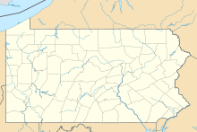
| Location of airport in Pennsylvania | |||||||||||
| Runways | |||||||||||
|
|||||||||||
| Statistics (2014) | |||||||||||
|
|||||||||||
|
Source: Federal Aviation Administration
|
|||||||||||
| Aircraft operations | 36,500 |
|---|---|
| Based aircraft | 111 |
Coordinates: 40°08′15″N 075°15′54″W / 40.13750°N 75.26500°W
Wings Field (ICAO: KLOM, FAA LID: LOM) is a general aviation airport in Blue Bell, in Whitpain Township in Montgomery County, Pennsylvania and serves the western and northern Philadelphia suburbs. The airport was founded in 1930 and is about three miles (5 km) northwest of Philadelphia.
In May 1930, John Story Smith and Jack Bartow Founded "Wings Port". On 24 April 1932, The Philadelphia Aviation Country Club was founded at the field. The country club was the location of meetings of members that eventually founded the worldwide Aircraft Owners and Pilots Association in 1939.
In 2011, investor and aviation business owner Regis de Ramel was awarded the contract to manage all operations of Wings Field through his company flyADVANCED. The field currently provides flight lessons, flight charters, fuel, hangar space and aircraft management for light jet and prop aircraft.
Wings Field covers 217 acres (88 ha) and has one asphalt runway, 6/24, 3,700 x 75 ft (1,128 x 23 m). In the year ending December 31, 2014, the airport had approximately 36,500 aircraft operations, an average of 100 per day: 83% general aviation, 17% air taxi and <1% military. 111 aircraft are based at this airport: 90% single-engine, 9% multi-engine, <1% jet and <1% helicopter.
...
Wikipedia

