Windlesham
| Windlesham | |
|---|---|
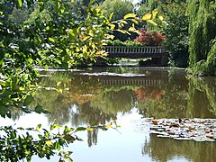
 The Arboretum |
|
 Windlesham House School |
|
| Windlesham shown within Surrey | |
| Area | 22.4 km2 (8.6 sq mi) |
| Population | 16,775 (Civil Parish 2011) |
| • Density | 749/km2 (1,940/sq mi) |
| OS grid reference | SU930635 |
| Civil parish |
|
| District | |
| Shire county | |
| Region | |
| Country | England |
| Sovereign state | United Kingdom |
| Post town | WINDLESHAM |
| Postcode district | GU20 |
| Dialling code | 01276, some 01344 |
| Police | Surrey |
| Fire | Surrey |
| Ambulance | South East Coast |
| EU Parliament | South East England |
| UK Parliament | |
Windlesham is a village in the Surrey Heath borough of Surrey, England and civil parish that covers Bagshot and Lightwater in the same borough. Its name derives from the Windle Brook which runs south of the village into Chobham and the common suffix 'ham', the Old English word for 'homestead'.
Today Windlesham has a main clustered community with various clubs. The main public parkland is linked by footpath across the M3 motorway cutting across the south of the parish, Windlesham Arboretum. Passing through its north is the A30 (London Road), two nearby train stations and Heathrow Airport make the settlement economically largely a commuter village. It has one church, St John the Baptist, the Windlesham Club and Theatre and six public houses.
A few large companies of late-20th-century origin have based themselves in Windlesham, including Rainbow Play Systems and the Linde Group.
The neighbourhood has yielded bronze implements, now in the Archaeological Society's Museum, Guildford, and a certain number of neolithic flints.
Windlesham was once a small community within Windsor Great Park, built as a remote farming settlement around undulating heath, similar to Sunninghill. At Ribs Down in the north in private Updown Court and adjoining gardens land reaches 99 metres above sea level with a minimum descent (notch/col) of 31 metres, ranking 35th of 36 Surrey hills listed in the national hill-climbing database and the tallest private hill in Surrey.
...
Wikipedia

