Wileroltigen
| Wileroltigen | ||
|---|---|---|

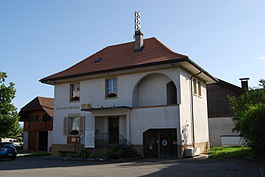
Municipal administration building of Wileroltigen
|
||
|
||
| Coordinates: 46°58′N 7°14′E / 46.967°N 7.233°ECoordinates: 46°58′N 7°14′E / 46.967°N 7.233°E | ||
| Country | Switzerland | |
| Canton | Bern | |
| District | Bern-Mittelland | |
| Government | ||
| • Mayor | Fritz Stooss-Stähli | |
| Area | ||
| • Total | 4.16 km2 (1.61 sq mi) | |
| Elevation | 513 m (1,683 ft) | |
| Population (Dec 2015) | ||
| • Total | 384 | |
| • Density | 92/km2 (240/sq mi) | |
| Postal code | 3207 | |
| SFOS number | 0671 | |
| Surrounded by | Ferenbalm, Golaten, Gurbrü, Kerzers (FR), Mühleberg | |
| Website |
www SFSO statistics |
|
Wileroltigen is a municipality in the Bern-Mittelland administrative district in the canton of Bern in Switzerland.
Wileroltigen is first mentioned in 1263 as Wiler sita prope Oltingen. The municipality was formerly known by its French name Ostranges, however, that name is no longer used.
During the Early Middle Ages the region around Wileroltigen belonged to St. Maurice's Abbey. In 962, the Abbey donated the land to Payerne Priory, which held it until the 13th century when the Herrschaft of Oltigen acquired the land. In 1412 the entire Herrschaft, including Wileroltigen, was absorbed by Bern. It was eventually combined with the villages of Gurbrü and Golaten to form a court in the bailiwick of Laupen. The village shared a bridge over the Saane/Sarine river with the village of Marfeldingen (part of the Mühleberg municipality) by 1325. During the 15th century it was replaced with a ferry. After the Act of Mediation, in 1803, Wileroltigen was assigned to the Canton of Bern despite the protests of the Canton of Fribourg.
In 1528 both Wileroltigen and the parish church at Kerzers converted to the new faith of the Protestant Reformation and the village remained part of the parish of Kerzers. However, the village St. Mary Magdalene chapel was abandoned after the Reformation. A village school opened in 1659.
...
Wikipedia


