Wilbraham, MA
| Wilbraham, Massachusetts | ||
|---|---|---|
| Town | ||

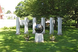
Veteran's Memorial
|
||
|
||
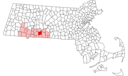
 Location in Hampden County in Massachusetts |
||
| Coordinates: 42°07′25″N 72°25′55″W / 42.12361°N 72.43194°WCoordinates: 42°07′25″N 72°25′55″W / 42.12361°N 72.43194°W | ||
| Country | United States | |
| State | Massachusetts | |
| County | Hampden | |
| Settled | 1730 | |
| Incorporated | 1763 | |
| Government | ||
| • Type | Open town meeting | |
| Area | ||
| • Total | 22.4 sq mi (58.1 km2) | |
| • Land | 22.2 sq mi (57.5 km2) | |
| • Water | 0.2 sq mi (0.5 km2) | |
| Elevation | 290 ft (88 m) | |
| Population (2010) | ||
| • Total | 14,868 | |
| • Density | 640.5/sq mi (247.3/km2) | |
| Time zone | Eastern (UTC-5) | |
| • Summer (DST) | Eastern (UTC-4) | |
| ZIP code | 01095 | |
| Area code(s) | 413 | |
| FIPS code | 25-79740 | |
| GNIS feature ID | 0619390 | |
| Website | http://www.wilbraham-ma.gov/ | |
Wilbraham is a town in Hampden County, Massachusetts, United States. It is a suburb of the City of Springfield, and part of the Springfield Metropolitan Statistical Area. The population was 14,868 at the 2010 census.
Part of the town comprises the census-designated place of Wilbraham.
Wilbraham was originally divided between North Wilbraham and Wilbraham. North Wilbraham was home to the industrial side of the town, along with the Boston & Albany Railroad Line, which is still in use today. Wilbraham was home to the Wilbraham & Monson Academy.
Wilbraham is made up of several neighborhoods, known as Wilbraham Center, North Wilbraham, East Wilbraham, Wilbraham Mountain, South Wilbraham, Boston Road Corridor and the Pines Section. In 1878, the south end of Wilbraham officially broke away from Wilbraham and formed the Town of Hampden. The term North Wilbraham is now rarely used by town residents and has been replaced by Wilbraham.
The name of Wilbraham comes from the villages of Little Wilbraham and Great Wilbraham located near Cambridge, England. The name originates from Wilburgham, a name indicating 'Wilburga's homestead', Wilburga being the daughter of the seventh century King Penda of the Mercians who gave her the land. In the 10th century (975 A.D.) it was still known as Wilburgeham; however in the Domesday Book it is known as Wiborgham. By the 1260s it was known as Great Wilbraham and right before that King's Wilbraham. During the Middle Ages the Knights Templar established a preceptory in 1226 in the villages. The manor house of Great Wilbraham was their temple and today it is still standing and is a house. Their regional headquarters was Denny Abbey in nearby Peterborough.
...
Wikipedia

