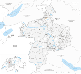
Wiggiswil
| Wiggiswil | ||
|---|---|---|
|
||
| Coordinates: 47°2′N 7°28′E / 47.033°N 7.467°ECoordinates: 47°2′N 7°28′E / 47.033°N 7.467°E | ||
| Country | Switzerland | |
| Canton | Bern | |
| District | Bern-Mittelland | |
| Area | ||
| • Total | 1.43 km2 (0.55 sq mi) | |
| Elevation | 554 m (1,818 ft) | |
| Population (Dec 2015) | ||
| • Total | 98 | |
| • Density | 69/km2 (180/sq mi) | |
| Postal code | 3053 | |
| SFOS number | 0553 | |
| Surrounded by | Ballmoos, Deisswil bei Münchenbuchsee, Moosseedorf, Münchenbuchsee, Urtenen-Schönbühl | |
| Website |
website missing SFSO statistics |
|
Wiggiswil is a municipality in the Bern-Mittelland administrative district in the canton of Bern in Switzerland.
Wiggiswil is first mentioned in 1219 as Wigersvile.
The oldest trace of a settlement in the area comes from scattered prehistoric flint tools which were found around the Moossee. Roman era artifacts have been discovered in Wiggiswil village and at Seerain.
Throughout its history Wiggiswil has always been dependent on the neighboring village of Deisswil bei Münchenbuchsee. Even in the 21st century, the two small municipalities share a single town council. It is part of the parish of Münchenbuchsee.
In 1973 the A6 motorway was built through the municipality. The motorway connects Wiggiswil to the cities of Bern and Biel/Bienne, however, the village has remained mostly agricultural. The village is home to the famous Moospinte hotel and restaurant which is over 150 years old. During World War II, Swiss commanding general Henri Guisan sometimes used the Moospinte for secret meetings with government officials. The current restaurant is still very well regarded and the Gault Millau guide gives it a 16 out of 20 rating.
Wiggiswil has an area of 1.43 km2 (0.55 sq mi). Of this area, 0.98 km2 (0.38 sq mi) or 68.5% is used for agricultural purposes, while 0.18 km2 (0.069 sq mi) or 12.6% is forested. Of the rest of the land, 0.24 km2 (0.093 sq mi) or 16.8% is settled (buildings or roads), 0.01 km2 (2.5 acres) or 0.7% is either rivers or lakes and 0.02 km2 (4.9 acres) or 1.4% is unproductive land.
Of the built up area, housing and buildings made up 3.5% and transportation infrastructure made up 8.4%. while parks, green belts and sports fields made up 4.2%. Out of the forested land, all of the forested land area is covered with heavy forests. Of the agricultural land, 55.9% is used for growing crops and 11.2% is pastures, while 1.4% is used for orchards or vine crops. All the water in the municipality is in lakes.
...
Wikipedia


