Whitehall Township, Lehigh County, Pennsylvania
| Whitehall Township | |
| Township | |
| Country | United States |
|---|---|
| State | Pennsylvania |
| County | Lehigh |
| Elevation | 384 ft (117.0 m) |
| Coordinates | 40°40′00″N 75°30′00″W / 40.66667°N 75.50000°WCoordinates: 40°40′00″N 75°30′00″W / 40.66667°N 75.50000°W |
| Area | 12.8 sq mi (33.2 km2) |
| - land | 12.6 sq mi (33 km2) |
| - water | 0.2 sq mi (1 km2), 1.56% |
| Population | 26,738 (2010) |
| Density | 1,981.1/sq mi (764.9/km2) |
| Timezone | EST (UTC-5) |
| - summer (DST) | EDT (UTC-4) |
| ZIP code | 18052 |
| Area code | 610 and 484 |
|
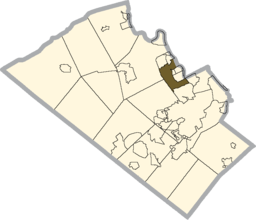
Location of Whitehall Township in Lehigh County
|
|
|
Website: www |
|
Whitehall Township is a township with home rule status in Lehigh County, Pennsylvania, in the United States. It is a suburb of Allentown, Pennsylvania, in the Lehigh Valley region of the state.
The population of Whitehall Township was 26,738 at the 2010 census.
The Province of Pennsylvania was created in 1681 when King Charles II granted a tract of land in the New World to William Penn. After the death of William Penn, his sons, John, Thomas and Richard, became the owners of Pennsylvania. The Delaware Indians deeded that part of Lehigh County lying between the Lehigh (South) Mountain and the Blue Mountains to Penn’s sons in 1736.
A wave of immigrants from Germany’s Palatinate settled in Whitehall Township, the first being Jacob Kohler, who settled in the vicinity of Egypt about 1728. The settlers staked their claim on the lands by applying to the Penn's for a land warrant. They cleared the land for farming and established churches around which villages grew.
When the first European settlers came to the Whitehall area, the Lenape Indians were living on the banks of the Hokendauqua River. The Europeans and the Lenape Indians gathered together and designed a deal based on how far the Europeans were able to walk in 2 days, that's how much land they would acquire. So to gain more land, the Europeans paid a professional runner. The runner was able to get as far as what is now Coaldale, Pennsylvania, in Schuylkill County. A walk east got them as far as Jim Thorpe, Pennsylvania.
The local tribe of Native Americans, the Lenni Lenapes, lived peacefully among the white settles for a time. The tribe suffered injustices at the hands of the settlers and lashed back during a 1763 uprising in Lehigh County. Fort Deshler, which stood near Rt. 145 at Chestnut Street, played a key role in the defense of settler-held lands during this battle, in which 23 settlers were killed.
The original Whitehall Township, established in 1753, was split into the three townships of Whitehall, North Whitehall, and south Whitehall in 1867. The name Whitehall is said to have originated from Lynford Lardner’s hunting lodge that was painted with whitewash. Lardner named it “Grouse Hall”, but the common people of the region called it “White Hall”. Whitehall Township ’s villages include Cementon, Egypt, Fullerton, Hokendauqua, Mickleys, Stiles and West Catasauqua. Coplay was also part of Whitehall until it incorporated as a borough in 1869.
...
Wikipedia


