Whiteclay, Nebraska
|
Whiteclay, Nebraska Makȟásaŋ |
|
|---|---|
| CDP | |
| Whiteclay, Nebraska | |

Nebraska Highway 87 forms the main street of Whiteclay
|
|
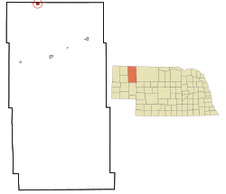
 Location of Pine Ridge, Nebraska |
|
| Coordinates: 42°59′37″N 102°33′34″W / 42.99361°N 102.55944°WCoordinates: 42°59′37″N 102°33′34″W / 42.99361°N 102.55944°W | |
| Country | United States |
| State | Nebraska |
| County | Sheridan |
| Area | |
| • Total | 1.0 sq mi (2.5 km2) |
| • Land | 0.9 sq mi (2.3 km2) |
| • Water | 0.08 sq mi (0.2 km2) |
| Population (2000) | |
| • Total | 14 |
| • Density | 15/sq mi (5.6/km2) |
| Time zone | Central (CST) (UTC-6) |
| • Summer (DST) | CDT (UTC-5) |
Whiteclay (Lakota: Makȟásaŋ; "whiteish or yellowish clay"), is an unincorporated community and census-designated place in Sheridan County, Nebraska, United States. The population was 14 at the 2000 census.
A significant part of Whiteclay's economy is based on alcohol sales to residents of the Pine Ridge Indian Reservation, located two miles (3.2 km) north across the border in South Dakota, where alcohol consumption and possession is prohibited. According to the Nebraska Liquor Control Commission, beer sales at Whiteclay's four liquor stores totalled 4.9 million cans in 2010 (~13,000 cans per day) for gross sales of $3 million. The four beer merchants paid federal and state excise taxes (included in liquor’s sale price) of $413,932 that year.
The border town of Whiteclay has always been tied to the Pine Ridge Indian Reservation to the north within the state boundaries of South Dakota. The majority of the Oglala Sioux Tribe (OST) live at Pine Ridge reservation. The Rosebud Sioux Tribe (Sicangu Oyate), also known as the Brulé Sioux, have an independent and federally recognized reservation to the northeast within the boundaries of South Dakota.
In 1882, after the boundaries of the Pine Ridge Indian Reservation were already established, by executive order the United States government added a 50-square-mile (130 km2) strip of land in Nebraska known as the White Clay Extension (named after White Clay Creek) to the reservation. The area was created to serve as a buffer zone to help prevent the sale of alcohol to residents of the reservation. The language of the order said that the buffer zone would be used until it was no longer considered necessary.
...
Wikipedia
