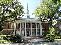
Weston, MA
| Weston, Massachusetts | ||
|---|---|---|
| Town | ||

Town Hall
|
||
|
||
 Location in Middlesex County in Massachusetts |
||
| Coordinates: 42°22′00″N 71°18′11″W / 42.36667°N 71.30306°WCoordinates: 42°22′00″N 71°18′11″W / 42.36667°N 71.30306°W | ||
| Country | United States | |
| State | Massachusetts | |
| County | Middlesex | |
| Settled | 1642 | |
| Incorporated | 1713 | |
| Area | ||
| • Total | 17.3 sq mi (44.9 km2) | |
| • Land | 17.0 sq mi (44.1 km2) | |
| • Water | 0.3 sq mi (0.8 km2) | |
| Elevation | 180 ft (55 m) | |
| Population (2010) | ||
| • Total | 11,261 | |
| • Density | 650/sq mi (250/km2) | |
| Time zone | Eastern (UTC-5) | |
| • Summer (DST) | Eastern (UTC-4) | |
| ZIP code | 02493 | |
| Area code(s) | 781 / 339 | |
| FIPS code | 25-77255 | |
| GNIS feature ID | 0618245 | |
| Website | www |
|
Weston is a town in Middlesex County, Massachusetts, United States in the Boston metro area. The population of Weston, as of the 2010 U.S. Census, was 11,261.
Weston is among the 10 most affluent towns with 1,000 or more households in the United States and is the third-most affluent town with a population of at least 10,000 in the United States. Weston is among the nation's 100 most expensive ZIP codes, with a median home price of well over $2 million. It is the only town in the Boston Area to have private roads, with state of the art police patrolling 24/7.
Despite a population of just 11,261, Weston's area is only slightly smaller than that of its neighbor town, Newton, Massachusetts which accounts for a much higher population of about 90,000. As a result, Weston's houses are on average much larger than those present in nearby towns, with considerable space between each individual residence. It has one of the lowest crime rates among Metro-west Boston suburbs.
Weston was a dry town from 1838 until 2008. Incorporated in 1713, the town is located on a rugged upland plateau.
The town of Weston was originally established as the West Precinct of Watertown in 1698. The town was separately incorporated as the town of Weston in 1713.
Weston is located on a rugged upland plateau. Early settlers discovered that the amount of useful agricultural land was limited as was the waterpower potential in the town. But colonists moving in from Watertown in the mid-17th century established scattered farms in Weston, and by 1679, a sawmill, several taverns, some doctors, and according to the historians, "probably some lawyers," had settled in Weston.
By the 18th century, residents were profiting by the traffic on the Boston Post Road. Taverns of great historic importance were established on the Road. The Golden Ball Tavern, built in 1750, and the Josiah Smith Tavern, built in 1757, still exist in the town. Unfortunately, commercial stagnation followed the loss of business after the opening of the Worcester Turnpike in 1810 drew commercial traffic from the Boston Post Road. Townspeople turned to boot and shoe making, and the manufacturing of cotton and woolen mill machinery. By 1870, substantial country estates were being built in Weston by Bostonians, establishing a prosperous residential character for the town. Farming continued to be a significant support for the local economy, and an organ factory opened in 1886 which employed some residents. The Weston Aqueduct and Reservoir were built in 1903 and the Hultman Aqueduct followed in 1938 to bring Quabbin Reservoir water into Boston. In exchange, Boston residents continued to build homes in Weston, many of them architect designed.
...
Wikipedia

