Westminster, South Carolina
| Westminster, South Carolina | |
|---|---|
| City | |

Southern Railway Passenger Station
|
|
| Motto: "We're trying a lot harder now" | |
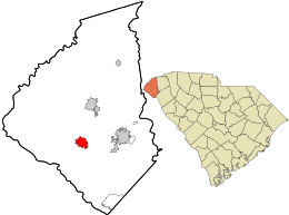
 Location in Oconee County and the state of South Carolina. |
|
| Coordinates: 34°39′59″N 83°5′43″W / 34.66639°N 83.09528°WCoordinates: 34°39′59″N 83°5′43″W / 34.66639°N 83.09528°W | |
| Country | United States |
| State | South Carolina |
| County | Oconee |
| Area | |
| • Total | 3.4 sq mi (8.9 km2) |
| • Land | 3.4 sq mi (8.9 km2) |
| • Water | 0.0 sq mi (0.0 km2) |
| Elevation | 955 ft (291 m) |
| Population (2010) | |
| • Total | 2,399 |
| • Density | 796.6/sq mi (307.6/km2) |
| Time zone | Eastern (EST) (UTC-5) |
| • Summer (DST) | EDT (UTC-4) |
| ZIP code | 29693 |
| Area code(s) | 864 |
| FIPS code | 45-76165 |
| GNIS feature ID | 1227504 |
| Website | www.westminstersc.org |
Westminster is a city in Oconee County, South Carolina, United States. The population was 2,399 at the 2010 census.
Westminster was founded on March 17, 1875 when the charter was signed.It was founded as a water stop on the Southern Railway. As stores, shops and factories started to set up around the train stop, it bloomed into a decent-sized town. Its peak of expansion came in the 1920s.
The Retreat Rosenwald School and Southern Railway Passenger Station are listed on the National Register of Historic Places.
Westminster is located at 34°39′59″N 83°5′43″W / 34.66639°N 83.09528°W (34.666292, -83.095352).
According to the United States Census Bureau, the city has a total area of 3.4 square miles (8.9 km²), all of it land.
As of the census of 2000, there were 2,743 people, 1,191 households, and 761 families residing in the city. The population density was 796.6 people per square mile (307.9/km²). There were 1,333 housing units at an average density of 387.1 per square mile (149.6/km²). The racial makeup of the city was 85.60% White, 11.81% African American, 0.04% Native American, 0.18% Asian, 1.20% from other races, and 1.17% from two or more races. Hispanic or Latino of any race were 2.48% of the population.
...
Wikipedia
